Near Chinese Camp in Tuolumne County, California — The American West (Pacific Coastal)
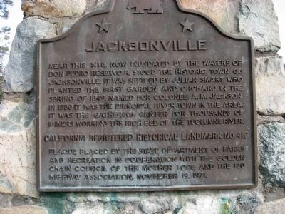
Jacksonville
Erected 1971 by State Department of Parks and Recreation in cooperation with the Golden Chain Council of the Mother Lode and the 120 Highway Association. (Marker Number 419.)
Topics and series. This historical marker is listed in these topic lists: Notable Events • Notable Places • Settlements & Settlers. In addition, it is included in the California Historical Landmarks, and the Mark Twain Bret Harte Trail series lists. A significant historical year for this entry is 1849.
Location. 37° 50.663′ N, 120° 22.889′ W. Marker is near Chinese Camp, California, in Tuolumne County. Marker is on State Highway 49, on the left when traveling south. 13.8 miles south of N. Washington Street & Stockton Road, downtown Sonora. Touch for map. Marker is in this post office area: Chinese Camp CA 95309, United States of America. Touch for directions.
Other nearby markers. At least 8 other markers are within 6 miles of this marker, measured as the crow flies. Don Pedro Lake (here, next to this marker); a different marker also named Jacksonville (approx. 1.9 miles away); Stevens Bar Bridge (approx. 1.9 miles away); Chinese Camp (approx. 3.3 miles away); To Honor Eddie Webb (approx. 3.3 miles away); Ferretti Shrine (approx. 3.7 miles away); Old Crimea House (approx. 5.4 miles away); Montezuma (approx. 5.9 miles away). Touch for a list and map of all markers in Chinese Camp.
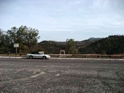
More about this marker. Very large turnout. Vista point for Don Pedro Reservoir.
Credits. This page was last revised on June 16, 2016. It was originally submitted on February 27, 2008, by Richard Wisehart of Sonora, California. This page has been viewed 1,752 times since then and 42 times this year. Photos: 1, 2. submitted on February 27, 2008, by Richard Wisehart of Sonora, California. • J. J. Prats was the editor who published this page.

