Near Sharpsburg in Washington County, Maryland — The American Northeast (Mid-Atlantic)
Greene's Division, Twelfth Army Corps
Greene's Division, Twelfth Army Corps,
Brig. Gen. Geo. S. Greene, Commanding,
(September 17, 1862.)
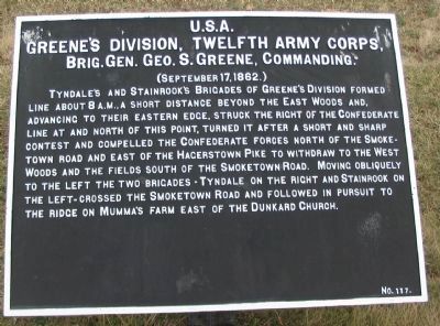
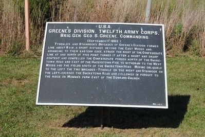
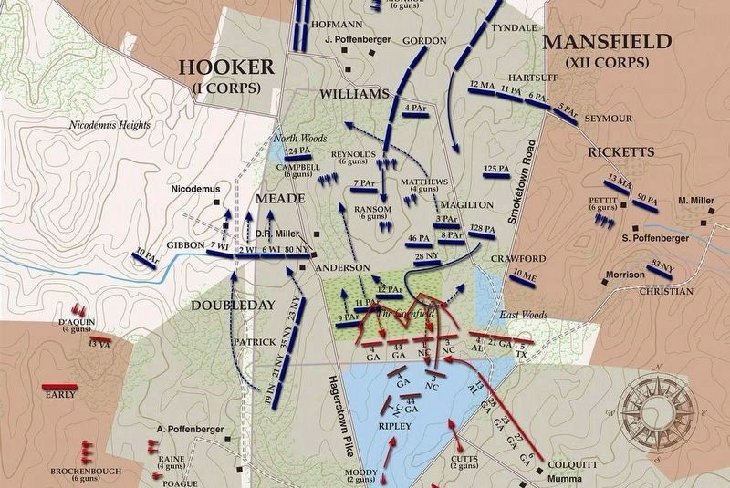
Tyndale's and Stainrook's Brigades of Greene's Division formed line about 8 a.m., a short distance beyond the East Woods and, advancing to their eastern edge, struck the right of the Confederate line at and north of this point, turned it after a short and sharp contest and compelled the Confederate forces north of the Smoketown Road and east of the Hagerstown Pike to withdraw to the West Woods and the fields south of the Smoketown Road. Moving obliquely to the left the two brigades - Tyndale on the right and Stainrook on the left - crossed the Smoketown Road and followed in pursuit to the ridge on Mumma's Farm east of the Dunkard Church.
Erected by Antietam Battlefield Board. (Marker Number 117.)
Topics and series. This historical marker is listed in this topic list: War, US Civil. In addition, it is included in the Antietam Campaign War Department Markers series list. A significant historical date for this entry is September 17, 1862.
Location. 39° 28.881′ N, 77° 44.514′ W. Marker is near Sharpsburg, Maryland, in Washington County. Marker is on Cornfield Avenue, on the right when traveling west. Located at the pull off for stop three of the driving tour of Antietam Battlefield. Touch for map. Marker is in this post office area: Sharpsburg MD 21782, United States of America. Touch for directions.
Other nearby markers. At least 10 other markers are within walking distance of this marker. "You Are Firing Into Our Own Men" (a few steps from this marker); The East Woods (a few steps from this marker); Jackson's Command (a few steps from this marker); Longstreet's Command (within shouting distance of this marker); 13th New Jersey Infantry (within shouting distance of this marker); Sixth Army Corps (about 400 feet away, measured in a direct line); a different marker also named Longstreet's Command (about 400 feet away); First New Jersey Brigade (about 500 feet away); a different marker also named Jackson's Command (about 600 feet away); U.S. Artillery (about 600 feet away). Touch for a list and map of all markers in Sharpsburg.
Regarding Greene's Division, Twelfth Army Corps. This marker is included on the East Woods Virtual Tour by Markers see the Virtual tour link below to see the markers in sequence.
Related markers. Click here for a list of markers that are related to this marker. Greene's Division markers.
Also see . . .
1. Antietam Batlefield. National Park Service site. (Submitted on February 28, 2008, by Craig Swain of Leesburg, Virginia.)
2. 2nd Division, XII Corps. The arrival of Greene's three brigade division broke the Confederate line in this sector, and caused a shift of the fighting to the West Woods and the Dunker Church area. (Submitted on February 28, 2008, by Craig Swain of Leesburg, Virginia.)
3. George S. Greene. George Sears Greene (May 6, 1801 – January 28, 1899) was a civil engineer and a Union general during the American Civil War. (Submitted on October 22, 2015, by Brian Scott of Anderson, South Carolina.)

Photographed By Craig Swain, February 9, 2008
3. East End of Cornfield Avenue - Driving Tour Stop Three
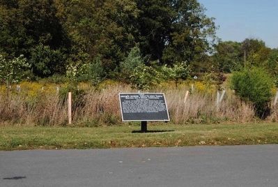
At the east end of Cornfield Avenue is a pull off for stop three. Around stop three stand War Department tablet #117 (Greene's Division) and a National Park Service interpretive marker, on the left or north side of the road. On the right, or south side, side of the road is War Department tablet #340 for Garland's Brigade.
Tyndall's Brigade of Green's division advanced across this ground, what was then part of the East Woods.
Tyndall's Brigade of Green's division advanced across this ground, what was then part of the East Woods.
Photographed By Brian Scott, September 19, 2015
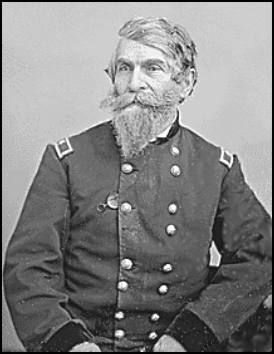
5. Brig. General George S. Greene (1801-1899)
Greene led a crushing attack against the Confederates near the Dunker Church, achieving the farthest penetration of Maj. Gen. Stonewall Jackson's lines than any Union unit. Under immense pressure, Greene held his small division in advance of the rest of the army for four hours, but eventually withdrew after suffering heavy losses

Photographed By Craig Swain, February 9, 2008
6. Advance of Greene's Division
Looking southwest from stop three. The Smoketown Road runs through the trees on the far left. The New York State monument can be seen in the distance through those trees. Following the line of telephone poles down the Smoketown Road is the area of the Dunker Church. Two of Greene's brigades broke through the East Woods here. Tyndall's advanced from what is today the Cornfield Avenue (did not exist at the time of the battle). Stainrook's was on his left, centered on the Smoketown Road. Both brigades advanced to the high ground near where the New York Monument stands today.
via American Battlefield Trust, unknown
7. East Woods Virtual Tour by Markers.
A collection of markers interpreting the action of during the Battle of Antietam around the East Woods.
(Submitted on March 8, 2008, by Craig Swain of Leesburg, Virginia.)
Click for more information.
(Submitted on March 8, 2008, by Craig Swain of Leesburg, Virginia.)
Click for more information.
Credits. This page was last revised on April 4, 2022. It was originally submitted on February 28, 2008, by Craig Swain of Leesburg, Virginia. This page has been viewed 908 times since then and 14 times this year. Photos: 1. submitted on February 28, 2008, by Craig Swain of Leesburg, Virginia. 2. submitted on October 22, 2015, by Brian Scott of Anderson, South Carolina. 3. submitted on February 28, 2008, by Craig Swain of Leesburg, Virginia. 4, 5. submitted on October 22, 2015, by Brian Scott of Anderson, South Carolina. 6. submitted on February 28, 2008, by Craig Swain of Leesburg, Virginia. 7. submitted on April 4, 2022, by Larry Gertner of New York, New York.
