Gerolzhofen in Schweinfurt, Bavaria, Germany — Central Europe
Dingolshäuser Gate
Dingolshäuser Tor
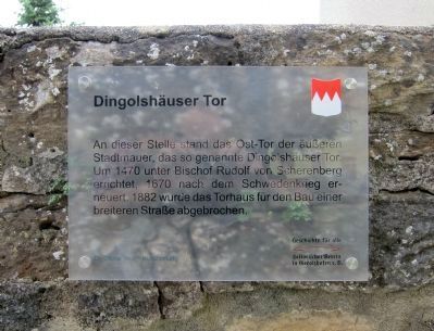
An dieser Stelle stand das Ost-Tor der äusseren Stadtmauer, das sogenannten Dingolshäuser Tor. Um 1470 unter Bischof Rudolf von Scherenberg errichtet. 1670 nach den Schwedenkrieg erneuert. 1882 wurde das Torhaus für den Bau einer breiteren Strasse abgebrochen.
Geschichte für alle
historischer Verein in Gerolzhofen, e.V.
Dr. Ottmar Wolf - Kulturstiftung
At this location stood the East Gate of the outer city walls, the so-called Dingolshäuser Gate. Erected about 1470 under Bishop Rudolf von Scherenberg. Renovated 1670 after the Swedish War. In 1882 the gate house was torn down for the construction of a wider roadway.
History for All - the Gerolzhofen Historical Society
Dr. Ottmar Wolf Cultural Foundation
Erected by The Gerolzhofen Historical Society and the Dr. Ottmar Wolf Cultural Foundation.
Topics. This historical marker is listed in this topic list: Forts and Castles. A significant historical year for this entry is 1470.
Location. 49° 53.986′ N, 10° 21.257′ E. Marker is in Gerolzhofen, Bayern (Bavaria), in Schweinfurt. Marker is at the intersection of Dingolshäuserstrasse and Östlichee Allee, on the right when traveling west on Dingolshäuserstrasse. Touch for map. Marker is in this post office area: Gerolzhofen BY 97447, Germany. Touch for directions.
Other nearby markers. At least 8 other markers are within walking distance of this marker. The Decline of the Jewish Community of Gerolzhofen from January 30, 1933 (about 150 meters away, measured in a direct line); Schallfelder Tor / Schallfeld Gate (about 210 meters away); The Former Adminstrative Building (about 240 meters away); Prison Tower (approx. 0.2 kilometers away); Fachwerkhaus Teutsch / Teutsch Building (approx. 0.3 kilometers away); Spital Gate (approx. 0.3 kilometers away); The Beadle’s Tower (approx. 0.3 kilometers away); Bürgerspital / Municipal Hospital (approx. 0.3 kilometers away). Touch for a list and map of all markers in Gerolzhofen.
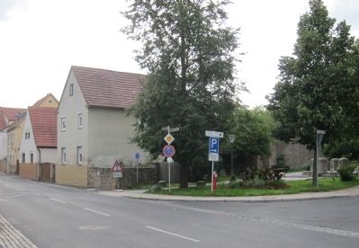
Photographed By Andrew Ruppenstein, July 18, 2012
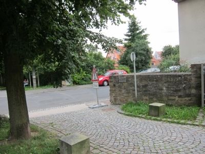
2. Dingolshäuser Gate Marker - wide view from the southeast
The marker is just barely visible here, to the immediate right of the "!" sign, mounted on the low wall. The marker is one of a series of historical markers put up since 2009 by the local historical society. The markers are printed on translucent plexiglass, which has the advantage of being unobtrusive, but has the disadvantage of being difficult to spot from a distance.
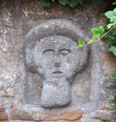
Photographed By Andrew Ruppenstein, July 18, 2012
5. Dingolshäuser Gate city wall - decorative element
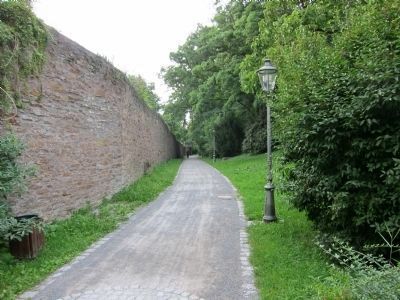
Just a few steps north of the marker is this decorative stone figure, set in the city wall. The marker location is a good starting point to explore the city walls, as a greenway extends both north and south from this point, offering a number of interesting things to see.
Credits. This page was last revised on January 7, 2024. It was originally submitted on July 29, 2012, by Andrew Ruppenstein of Lamorinda, California. This page has been viewed 567 times since then and 8 times this year. Photos: 1, 2, 3, 4, 5, 6. submitted on July 29, 2012, by Andrew Ruppenstein of Lamorinda, California. • Syd Whittle was the editor who published this page.
