Cuylerville in Livingston County, New York — The American Northeast (Mid-Atlantic)
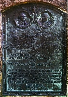
Routes of the Armies
Inscription.
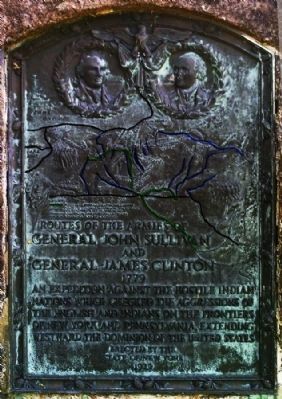
Routes of the Armies
of General John Sullivan and General James Clinton 1779
An expedition against the hostile Indian nations which checked the aggressions of the English and Indians of the frontier of New York and Pennsylvania, extending westward the dominion of the United States.
Erected 1929 by State of New York.
Topics and series. This historical marker is listed in this topic list: War, US Revolutionary. In addition, it is included in the The Sullivan-Clinton Expedition Against the Iroquois Indians series list. A significant historical year for this entry is 1779.
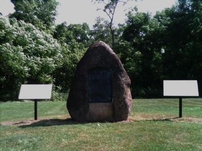
Location. 42° 46.604′ N, 77° 51.716′ W. Marker is in Cuylerville, New York, in Livingston County. Marker is on Cuylerville Road (U.S. 20A) ¼ mile west of Barrett Road. Touch for map. Marker is in this post office area: Leicester NY 14481, United States of America. Touch for directions.
Other nearby markers. At least 8 other markers are within walking distance of this marker. Genesee Castle (here, next to this marker); The International Society of Arboriculture and the National Arborist Association (a few steps from this marker); Boyd – Parker (within shouting distance of this marker); Boyd & Parker Park (about 300 feet away, measured in a direct line); This wayside shrine marks the place (about 400 feet away); Cuylerville (approx. 0.4 miles away); National Hotel (approx. half a mile away); Moscow Landing (approx. one mile away). Touch for a list and map of all markers in Cuylerville.
Credits. This page was last revised on June 16, 2016. It was originally submitted on August 2, 2012, by Yugoboy of Rochester, New York. This page has been viewed 658 times since then and 18 times this year. Photos: 1, 2, 3. submitted on August 2, 2012, by Yugoboy of Rochester, New York. • Bill Pfingsten was the editor who published this page.


