Financial District in San Francisco City and County, California — The American West (Pacific Coastal)
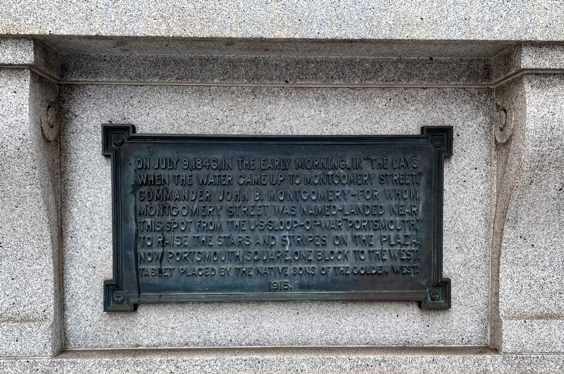
Commander John B. Montgomery's Landing Site
Erected 1915 by Native Sons of the Golden West. (Marker Number 81.)
Topics and series. This historical marker is listed in these topic lists: Military • Notable Events • War, Mexican-American. In addition, it is included in the California Historical Landmarks, and the Native Sons/Daughters of the Golden West series lists. A significant historical month for this entry is July 1902.
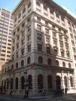
Location. 37° 47.677′ N, 122° 24.181′ W. Marker is in San Francisco, California, in San Francisco City and County. It is in the Financial District. Marker is at the intersection of Montgomery Street and Clay Street, on the right when traveling north on Montgomery Street. Touch for map. Marker is at or near this postal address: 550 Montgomery Street, San Francisco CA 94111, United States of America. Touch for directions.
Other nearby markers. At least 8 other markers are within walking distance of this marker. Bank of Italy (here, next to this marker); "The Family" (within shouting distance of this marker); Western Headquarters of Russell, Majors, and Waddell (within shouting distance of this marker); Hudson's Bay Company (within shouting distance of this marker); Pony Express (within shouting distance of this marker); Site of First U.S. Branch Mint (within shouting distance of this marker); The San Francisco Society for the Prevention of Cruelty to Animals (within shouting distance of this marker); Former Site of Eureka Lodgings (about 300 feet away, measured in a direct line). Touch for a list and map of all markers in San Francisco.
Also see . . . California Landmark 81 - noehill.com. "Seventy years after the American Revolution, Yerba Buena was a remote Mexican pueblo of about 450 souls. This changed on July 9, 1846, when the United States warship Portsmouth anchored in Yerba Buena Cove, and Capt. John B. Montgomery rowed ashore with a small detachment of sailors and marines to raise the American flag in the plaza." (Submitted on August 13, 2012, by Barry Swackhamer of Brentwood, California.)
Credits. This page was last revised on February 7, 2023. It was originally submitted on August 13, 2012, by Barry Swackhamer of Brentwood, California. This page has been viewed 846 times since then and 41 times this year. Last updated on December 11, 2019, by Craig Baker of Sylmar, California. Photos: 1. submitted on July 12, 2021. 2. submitted on August 13, 2012, by Barry Swackhamer of Brentwood, California. • J. Makali Bruton was the editor who published this page.

