Petersburg in Grant County, West Virginia — The American South (Appalachia)
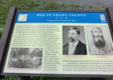
War in Grant County
Engagement at Johnson Run
The Union Home Guard unit was returning with supplies from New Creek Station (present day Keyser) on the Baltimore and Ohio Railroad about 35 miles north of here. Despite the distance, the station was the closest railroad depot to Petersburg, and the guard periodically made the 70-mile roundtrip trek to obtain supplies. On June 19, the guardsmen encountered Dolan and his 25-man detachment posted near here east of the Petersburg and Franklin Road (today’s U.S. Route 220) and south of Johnson Run in woods near an old icehouse. A body of the Rangers charged, and the guard fell back to a hill to make a stand. During the ensuing fight, Dolan was killed, while Rangers killed four guards-men and took three prisoners. The guard successfully defended its wagon train and withdrew.
The next day, Lt. Adam Yokum led a detachment of the guard to the battleground and reoccupied the hill. The Rangers observed Yokum and his men, circled around behind the hill, and attacked the Union rear. Two Federals were killed and one wounded before the Rangers withdrew.
Erected by West Virginia Civil War Trails.
Topics and series. This historical marker is listed in this topic list: War, US Civil. In addition, it is included in the West Virginia Civil War Trails series list. A significant historical month for this entry is June 1863.
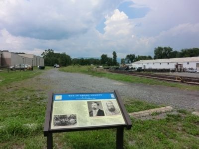
Location. 38° 59.118′ N, 79° 7.5′ W. Marker is in Petersburg, West Virginia, in Grant County. Marker is at the intersection of South Main Street (U.S. 220) and C Street on South Main Street. Touch for map. Marker is in this post office area: Petersburg WV 26847, United States of America. Touch for directions.
Other nearby markers. At least 8 other markers are within 2 miles of this marker, measured as the crow flies. Fairfax Line (approx. half a mile away); The Tannery in Petersburg, WV (approx. 0.6 miles away); Fort Mulligan (approx. 0.6 miles away); Maple Hill Cemetery (approx. 0.9 miles away); A Strategic Location (approx. 1.3 miles away); Civil War Cannons (approx. 1.3 miles away); Parrott Rifle (approx. 1.3 miles away); Defending the Fort (approx. 1.3 miles away). Touch for a list and map of all markers in Petersburg.
Credits. This page was last revised on January 29, 2019. It was originally submitted on August 23, 2012, by Don Morfe of Baltimore, Maryland. This page has been viewed 848 times since then and 34 times this year. Last updated on January 29, 2019, by Manuel J. Ortuno of Wacom, Texas. Photos: 1, 2. submitted on August 23, 2012, by Don Morfe of Baltimore, Maryland. • Andrew Ruppenstein was the editor who published this page.

