Near Dunn in Harnett County, North Carolina — The American South (South Atlantic)
Battle of Averasboro
Sherman’s Left Wing Departs Averasboro
— Carolinas Campaign —
Inscription.
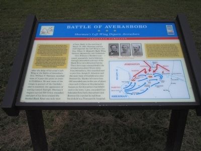
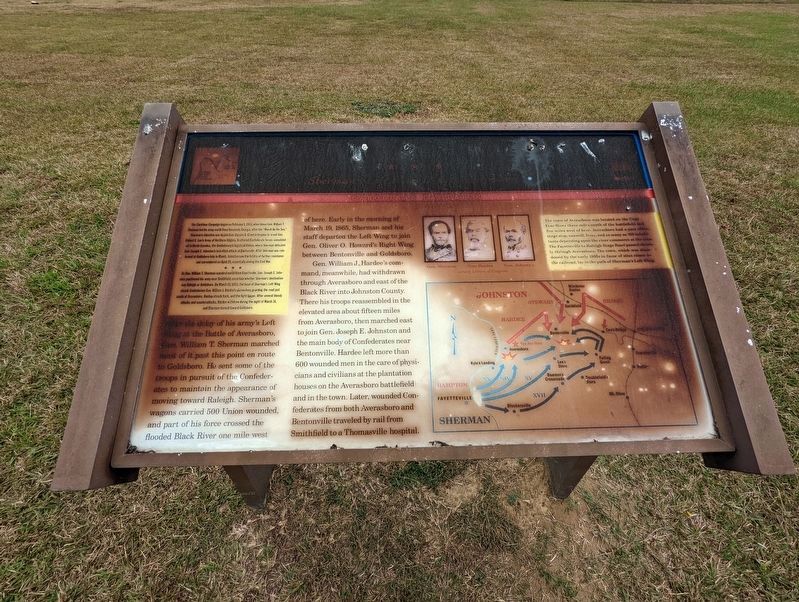
(Preface):The Carolinas Campaign began on February 1, 1865, when Union Gen. William T. Sherman led his army north from Savannah, Georgia, after the “March to the Sea.” Sherman’s objective was to join Gen. Ulysses S. Grant in Virginia to crush Gen. Robert E. Lee’s Army of Northern Virginia. Scattered Confederate forces consolidated in North Carolina, the Confederacy’s logistical lifeline, where Sherman defeated Gen. Joseph E. Johnston’s last-ditch attack at Bentonville. After Sherman was reinforced at Goldsboro late in March, Johnston saw the futility of further resistance and surrendered on April 26, essentially ending the Civil War.
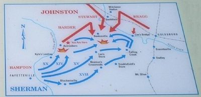
After the delay of his army’s Left Wing at the Battle of Averasboro, Gen. William T. Sherman marched most of it past this point en route to Goldsboro. He sent some of the troops in pursuit of the Confederates to maintain the appearance of moving towards Raleigh. Sherman’s wagons carried 500 Union wounded, and part of his force crossed the flooded Black River one mile west of here. Early on the morning of March 19, 1865, Sherman and his staff departed the Left Wing to join Gen. Oliver O. Howard’s Right Wing between Bentonville and Goldsboro.
Gen. William J. Hardee’s command, meanwhile, had withdrawn through Averasboro and east of the Black River into Johnston County. There his troops reassembled in the elevated area about fifteen miles from Averasboro, then marched east to join Gen. Joseph E. Johnston and the main body of Confederates near Bentonville. Hardee left more than 600 wounded men in the care of physicians and civilians at the plantation houses on the Averasboro battlefield and in the town. Later, wounded Confederates from both Averasboro and Bentonville traveled by rail from Smithfield to a Thomasville hospital.
(Sidebar): The town of Averasboro was located on the Cape Fear River three miles north of the battlefield and five miles west of here. Averasboro had a post office, stage stop, sawmill, ferry, and as many as 700 inhabitants depending upon the river commerce at the time. The Fayetteville to Raleigh Stage Road passed directly through Averasboro. The town, which was abandoned by early 1900s in favor of sites closer
to the railroad, lay in the path of Sherman’s Left Wing.
Erected by North Carolina Civil War Trails.
Topics and series. This historical marker is listed in this topic list: War, US Civil. In addition, it is included in the North Carolina Civil War Trails series list. A significant historical date for this entry is February 1, 1865.
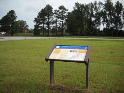
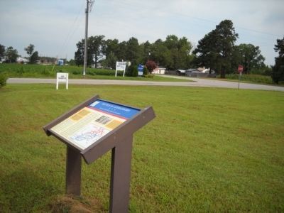
Location. 35° 16.5′ N, 78° 37.54′ W. Marker has been damaged. Marker is near Dunn, North Carolina, in Harnett County. Marker is at the intersection of Norma Drive and Longbranch Road, on the left when traveling south on Norma Drive. Touch for map. Marker is in this post office area: Dunn NC 28334, United States of America. Touch for directions.
Other nearby markers. At least 8 other markers are within 3 miles of this location, measured as the crow flies. Sherman's March (approx. ¼ mile away); Link Wray (approx. 1.9 miles away); a different marker also named Battle of Averasboro (approx. 2.1 miles away); G. B. Cashwell (approx. 2.4 miles away); William C. Lee (approx. 2.4 miles away); "Lebanon" (approx. 2.6 miles away); a different marker also named Battle of Averasboro (approx. 2.7 miles away); North Carolina (approx. 2.7 miles away). Touch for a list and map of all markers in Dunn.
More about this marker. The marker displays portraits of Gens. Sherman, Hardee, and Johnston in the upper center. Below the portraits a campaign map depicts the movements of the armies at this stage of the Carolinas Campaign.
Also see . . . Battle of Averasboro. Civil War Album offers several pages of photos of the Averasboro battlefield. (Submitted on January 28, 2008, by Craig Swain of Leesburg, Virginia.)
Credits. This page was last revised on November 14, 2022. It was originally submitted on January 28, 2008. This page has been viewed 2,734 times since then and 26 times this year. Last updated on November 23, 2020, by Bradley Owen of Morgantown, West Virginia. Photos: 1. submitted on January 28, 2008, by Bill Coughlin of Woodland Park, New Jersey. 2. submitted on November 12, 2022, by Michael Buckner of Durham, North Carolina. 3, 4. submitted on August 3, 2010, by Bill Coughlin of Woodland Park, New Jersey. 5. submitted on January 28, 2008, by Bill Coughlin of Woodland Park, New Jersey. • J. Makali Bruton was the editor who published this page.
