Charleston in Kanawha County, West Virginia — The American South (Appalachia)
Battle of Charleston
Lightburn's Retreat
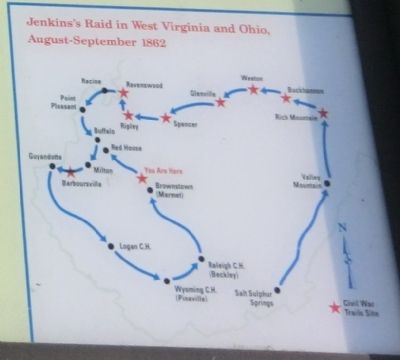
— Jenkins's Raid —
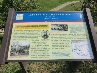
As Confederate Gen. Albert G. Jenkins conducted his raid through western Virginia, Union Col. Joseph A.J. Lightburn began consolidating scattered Federal forces to defend important positions and resources. Not only Jenkins, but also Confederate Gen. William W. Loring, acting in concert with Jenkins, threatened Union positions. Leading a combined command of infantry, cavalry, and horse artillery, Loring struck at Federal forces in the Kanawha River Valley.
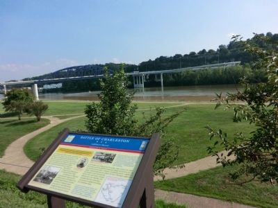
On September 13, 1862, part of Loring’s force caught up with Lightburn here as the Federals withdrew through Charleston and down the valley. A Confederate detachment under Col. John McCausland occupied the high ground across the river from here and posted cannons on the heights west of the present I-64 bridge. Under artillery fire, Lightburn’s men crossed the Elk River Suspension Bridge that stood to your left rear and then cut the cables to obstruct a Confederate pursuit. Lightburn’s column, which included not only soldiers, but also a 700-wagon supply train and hundreds of loyal Unionists and slaves on foot and in boats, retreated fighting west to the Ohio River. His successful fifty-mile retreat kept a vast quantity of supplies from falling into Confederate hands.
Erected by West Virginia Civil War Trails.
Topics and series. This historical marker is listed in this topic list: War, US Civil. In addition, it is included in the West Virginia Civil War Trails series list. A significant historical month for this entry is September 1805.
Location. 38° 21.498′ N, 81° 38.988′ W. Marker is in Charleston, West Virginia, in Kanawha County. Marker is at the intersection of Kanawha Boulevard (U.S. 60) and Ohio Avenue, on the right when traveling east on Kanawha Boulevard. Touch for map. Marker is at or near this postal address: 209 Kanawha Boulevard, Charleston WV 25302, United States of America. Touch for directions.
Other nearby markers. At least 8 other markers are within walking distance of this marker. A different marker also named Battle of Charleston (about 700 feet away, measured in a direct line); Pony Express (approx. ¼ mile away); George W. Summers (approx. 0.4 miles away); The Legend Of John Henry (approx. half a mile away); Fort Scammon (approx. 0.6 miles away); Breezemont (approx. ¾ mile away); Military Occupation (approx. ¾ mile away); Presidential Presence (approx. ¾ mile away). Touch for a list and map of all markers in Charleston.
Credits. This page was last revised on June 16, 2016. It was originally submitted on September 3, 2012, by Don Morfe of Baltimore, Maryland. This page has been viewed 806 times since then and 17 times this year. Photos: 1, 2. submitted on September 3, 2012, by Don Morfe of Baltimore, Maryland. 3. submitted on September 10, 2012, by Don Morfe of Baltimore, Maryland. • Craig Swain was the editor who published this page.


