Alderson in Monroe County, West Virginia — The American South (Appalachia)
Alderson's Ferry
Strategic Crossing
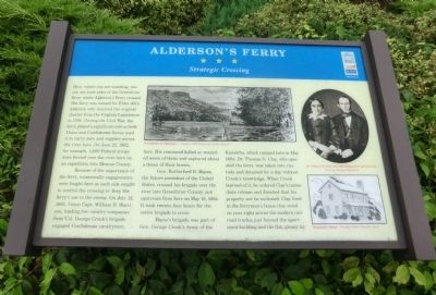
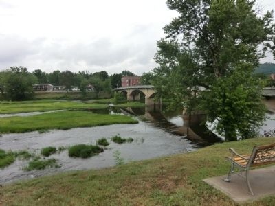
Here, where you are standing, you can see both sides of the Greenbrier River where Alderson’s Ferry crossed. The ferry was named for Elder John Alderson who received the original charter from the Virginia Legislature in 1786. During the Civil War, the ferry played a significant role as both Union and Confederate forces used it to carry men and supplies across the river here. On June 22, 1862 for example, 1,600 Federal troops were ferried over the river here on an expedition into Monroe County.
Because of the importance of the ferry, occasionally engagements were fought here as each side sought to control the crossing or deny the ferry’s use to the enemy. On July 12, 1862, Union Capt. William B. Harrison, leading two cavalry companies from Col. George Crook’s brigade, engaged Confederate cavalrymen here. His command killed or wounded seven of them and captured about a dozen of their horses.
Gen. Rutherford B. Hayes, the future president of the United States, crossed his brigade over the river into Greenbrier County just upstream from here on May 18, 1864. It took twenty-four hours for the entire brigade to cross.
Hayes’s brigade was part of Gen. George Crook’s Army of the Kanawha, which camped here in May 1864. Dr. Thomas G. Clay, who operated the ferry, was taken into custody and detained for a day without Crook’s knowledge. When Crook learned of it, he ordered Clay's immediate release and directed that his property not be molested. Clay lived in the ferryman’s house that stood on your right across the modern railroad tracks, just beyond the apartment building and the flat, grassy lot.
Erected by West Virginia Civil War Trails.
Topics and series. This historical marker is listed in this topic list: War, US Civil. In addition, it is included in the West Virginia Civil War Trails series list. A significant historical month for this entry is May 1973.
Location. 37° 43.458′ N, 80° 38.586′ W. Marker is in Alderson, West Virginia, in Monroe County. Marker is at the intersection of South Monroe Street (West Virginia Route 3) and Railroad Avenue on South Monroe Street. Touch for map. Marker is in this post office area: Alderson WV 24910, United States of America. Touch for directions.
Other nearby markers. At least 8 other markers are within 7 miles of this marker, measured as the crow flies. Greenbrier County / Monroe County (a few steps from this marker); Alderson Memorial Bridge History (about 500 feet away, measured in a direct line); Alderson (about 600 feet away); Alderson Lion (about 600 feet away); Alderson Baptist Academy and Junior College (approx. 0.3 miles away); Reformatory for Women (approx. 0.4 miles away); Greenbrier County / Summers County (approx. 1.3 miles away); Fort Greenbrier (approx. 6.9 miles away). Touch for a list and map of all markers in Alderson.
Credits. This page was last revised on December 26, 2023. It was originally submitted on September 10, 2012, by Don Morfe of Baltimore, Maryland. This page has been viewed 814 times since then and 43 times this year. Last updated on December 25, 2023, by Carl Gordon Moore Jr. of North East, Maryland. Photos: 1, 2, 3, 4. submitted on September 10, 2012, by Don Morfe of Baltimore, Maryland. • Devry Becker Jones was the editor who published this page.


