Cloudcroft in Otero County, New Mexico — The American Mountains (Southwest)
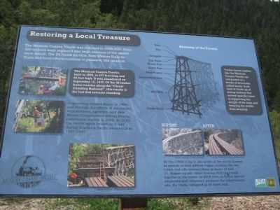
Restoring a Local Treasure
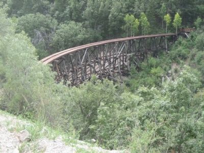
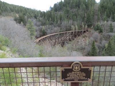
The Mexican Canyon Trestle, built in 1899, is 323 feet long and 60 feet high. It was abandoned on September 12, 1947. Of the 58 timber frame trestles along the "Cloud-Climbing Railroad", this trestle is the last that remains standing.
Engineering studies began in 1989, and through the efforts of volunteers, organizations, agencies, and New Mexico Congressman Stevan Pearce, restoration started in 2009. In 2010, the trestle again looked as it had during Southern Pacific ownership in 1937-1947.
Timber frame trestles like the Mexican Canyon Trestle are comprised of a series of structures called bents. Each bent is made up of strong timbers that served specific roles in supporting the weight of the train and keeping the trestle from swaying.
By the 1980s a dip in the center of the trestle formed as several vertical timbers began crushing the two rotten mid-sills between them at bents 10 and 11. Almost equally rotten bracing held the trestle together in the center. In 2008 even as Forest Service employees and volunteers prepared the construction site, the trestle collapsed at its north end.
Topics. This historical marker is listed in this topic list: Railroads & Streetcars. A significant historical month for this entry is September 1812.
Location. 32° 57.858′ N, 105° 44.869′ W. Marker is in Cloudcroft, New Mexico, in Otero County. Marker is on U.S. 82, on the right when traveling east. Touch for map. Marker is in this post office area: Cloudcroft NM 88317, United States of America. Touch for directions.
Other nearby markers. At least 3 other markers are within 16 miles of this marker, measured as the crow flies. Cloud-Climbing Railroad (here, next to this marker); Blazer’s Mill (approx. 14.6 miles away); Round Mountain (approx. 15.2 miles away).
Credits. This page was last revised on June 16, 2016. It was originally submitted on September 10, 2012, by Jennifer W. of Las Cruces, New Mexico. This page has been viewed 705 times since then and 27 times this year. Photos: 1, 2. submitted on September 4, 2012, by Jennifer W. of Las Cruces, New Mexico. 3, 4. submitted on May 4, 2014, by Bill Kirchner of Tucson, Arizona. • Syd Whittle was the editor who published this page.
Editor’s want-list for this marker. Wide area view of the marker and its surroundings. • Can you help?


