Kanarraville in Iron County, Utah — The American Mountains (Southwest)
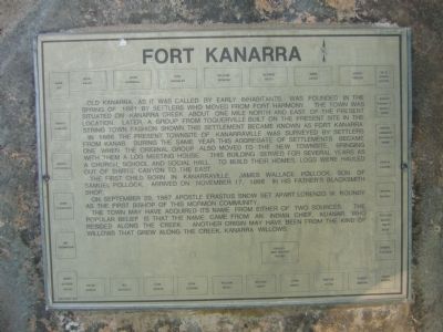
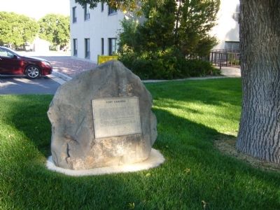
Fort Kanarra
In 1866 the present townsite of Kanarraville was surveyed by settlers from Kanab. During the same year this aggregate of settlements became one when the original group also moved to the new townsite, bringing with them a log meeting house. This building served for several years as a church, school and social hall. To build their homes, logs were hauled out of Shirts' Canyon to the east.
The first child born in Kanarraville, James Wallace Pollock, son of Samuel Pollock, arrived on November 17, 1866 in his father's blacksmith shop.
On September 29, 1867 Apostle Erastus Snow set apart Lorenzo W. Roundy as the first Bishop of this Mormon community.
The town may have acquired its name from either of two sources. The popular belief is that the name came from an Indian Chief, Kuanar, who resided along the creek. Another origin may have been from the kind of willows that grew along the creek, Kanarra Willows
Erected 1976.
Topics. This historical marker is listed in these topic lists: Forts and Castles • Settlements & Settlers. A significant historical month for this entry is September 1852.
Location. 37° 32.215′ N, 113° 10.994′ W. Marker is in Kanarraville, Utah, in Iron County. Marker is on South Main Street, on the right when traveling south. Touch for map. Marker is at or near this postal address: 80 South Main Street, Kanarraville UT 84742, United States of America. Touch for directions.
Other nearby markers. At least 8 other markers are within 10 miles of this marker, measured as the crow flies. South Rim of the Great Basin (approx. 3 miles away); Fort Harmony (approx. 5.1 miles away); Hamilton Fort (approx. 6.9 miles away); Kolob Canyons (approx. 7.1 miles away); Collapsing Scenery (approx. 7.1 miles away); Military Training Camp Site (approx. 7.4 miles away); New Harmony (approx. 8 miles away); Hornet Hill Monument (approx. 9.6 miles away).
Credits. This page was last revised on June 16, 2016. It was originally submitted on September 14, 2012, by Bill Kirchner of Tucson, Arizona. This page has been viewed 742 times since then and 17 times this year. Photos: 1, 2, 3. submitted on September 14, 2012, by Bill Kirchner of Tucson, Arizona. • Bill Pfingsten was the editor who published this page.


