Napier Township near Bedford in Bedford County, Pennsylvania — The American Northeast (Mid-Atlantic)
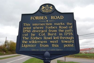
Forbes Road
Erected by Pennsylvania Historical and Museum Commission.
Topics and series. This historical marker is listed in these topic lists: Roads & Vehicles • War, French and Indian. In addition, it is included in the Forbes Road, and the Pennsylvania Historical and Museum Commission series lists. A significant historical year for this entry is 1758.
Location. 40° 2.57′ N, 78° 33.593′ W. Marker is near Bedford, Pennsylvania, in Bedford County. It is in Napier Township. Marker is at the intersection of Lincoln Highway (U.S. 30) and Pennsylvania Route 31 on Lincoln Highway. The marker is located at the intersection of U.S. Route 30 and PA Route 31 in Napier Township, approximately 1.5 miles west of Wolfsburg. Touch for map. Marker is in this post office area: Bedford PA 15522, United States of America. Touch for directions.
Other nearby markers. At least 8 other markers are within 3 miles of this marker, measured as the crow flies. A different marker also named Forbes Road (here, next to this marker); Traveling The Highway (about 300 feet away, measured in a direct line); Bonnet Tavern (about 400 feet away); From Motor Camping to Tourist Cabins (approx. 1.9 miles away); The Coffee Pot (approx. 2.6 miles away); Bedford Village (approx. 2.6 miles away); Gold Star Mothers of Bedford County (approx. 2.8 miles away); Bedford County and Fulton County Veterans Memorial (approx. 2.9 miles away). Touch for a list and map of all markers in Bedford.
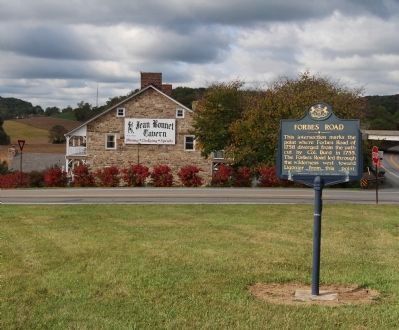
More about this marker. The Forbes Road monument is steps away from this
PAHMC marker. The historic 18th Century Jean Bonnet Tavern is also nearby.
Credits. This page was last revised on February 7, 2023. It was originally submitted on September 24, 2012, by Dave Kerr of Carlisle, Pennsylvania. This page has been viewed 704 times since then and 20 times this year. Photos: 1. submitted on January 6, 2013, by Mike Wintermantel of Pittsburgh, Pennsylvania. 2. submitted on September 24, 2012, by Dave Kerr of Carlisle, Pennsylvania. • Bill Pfingsten was the editor who published this page.

