Allegheny Township near Central City in Somerset County, Pennsylvania — The American Northeast (Mid-Atlantic)
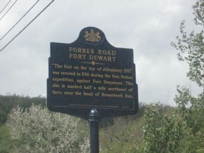
Forbes Road
Fort Dewart
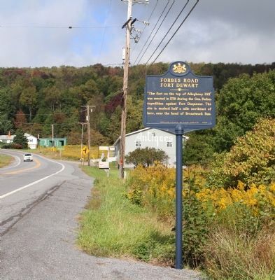
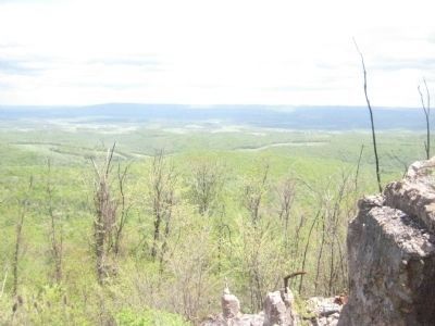
"The fort on the top of Allegheny Hill" was erected in 1758 during the Gen. Forbes expedition against Fort Duquesne. The site is marked half a mile northeast of here, near the head of Breastwork Run.
Erected 2005 by Pennsylvania Historical and Museum Commission.
Topics and series. This historical marker is listed in these topic lists: Colonial Era • Roads & Vehicles • War, French and Indian. In addition, it is included in the Forbes Road, and the Pennsylvania Historical and Museum Commission series lists. A significant historical year for this entry is 1758.
Location. 40° 2.322′ N, 78° 46.044′ W. Marker is near Central City, Pennsylvania, in Somerset County. It is in Allegheny Township. Marker is on Lincoln Highway (U.S. 30) half a mile east of New Baltimore Road, on the right when traveling east. Touch for map. Marker is in this post office area: Berlin PA 15530, United States of America. Touch for directions.
Other nearby markers. At least 8 other markers are within 6 miles of this marker, measured as the crow flies. Over the Summit (approx. half a mile away); Jacob Kinsey (Kintzy) Homestead (approx. 2.4 miles away); Somerset County Bridge No. 5 • New Baltimore Covered Bridge (approx. 3.6 miles away); New Baltimore Veterans Memorial (approx. 3.6 miles away); Lincoln Highway Heritage Corridor (approx. 4.6 miles away); American Legion Post 449 War Memorial (approx. 5.2 miles away); a different marker also named Forbes Road (approx. 5.4 miles away); 1806 Old Log Church (approx. 6 miles away).
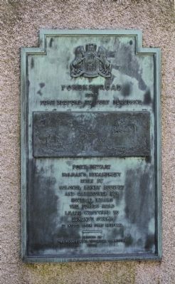
Regarding Forbes Road. "The fort on the top of Allegheny Hill," was erected in 1758 as a way station along Forbes Road between Carlisle and Pittsburgh during General Forbes' campaign against French Fort Duquesne. Never regularly garrisoned, Fort Dewart however was of some use to British and Provincial troops during the war.
Source: Encyclopedia of the French & Indian War in North America, 1754-1763 By Donald I. Stoetzel
Also see . . . Defending Fort Dewart, a Legacy of Stewardship. Pennsylvania State Historic Preservation Office blog entry (Submitted on February 19, 2022, by Larry Gertner of New York, New York.)
Additional commentary.
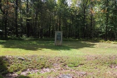
1. Entrance to Fort Duard (Dewart)
For those who may not know: There is a small sign marking the entrance to the road leading to the Fort Duard site. It is on Fleegle Road (formerly Mountain Road) Approximately 1 mile from the Route 30 turnoff.
Editor's Note: Various sources note the location of the fort as along Fleegle (Mountain) Road and somewhere between one half mile and 3.6 miles from its intersection with Route 30. The fort is within Somerset County. The Bedford County border is about 3.6 miles from the Route 30 intersection.
At one time, the site was open to the public one day per year. However, information about the annual event has not been updated in two years, so that may no longer be the case. For more information, we recommend you contact the Somerset County Chamber of Commerce, 601 North Center Avenue, Somerset, Pa 15501
Phone: (814) 445-6431
Email: [email protected] Note To Editor only visible by Contributor and editor
— Submitted April 13, 2010, by Donald A. Scarborough of West Mifflin, Pa..
Credits. This page was last revised on February 7, 2023. It was originally submitted on June 11, 2008, by F. Robby of Baltimore, Maryland. This page has been viewed 3,621 times since then and 99 times this year. Last updated on September 25, 2012, by Dave Kerr of Carlisle, Pennsylvania. Photos: 1. submitted on June 11, 2008, by F. Robby of Baltimore, Maryland. 2. submitted on September 23, 2012, by Dave Kerr of Carlisle, Pennsylvania. 3, 4. submitted on September 25, 2012, by Dave Kerr of Carlisle, Pennsylvania. 5. submitted on June 11, 2008, by F. Robby of Baltimore, Maryland. • Bill Pfingsten was the editor who published this page.
