Near Stroud in Lincoln County, Oklahoma — The American South (West South Central)
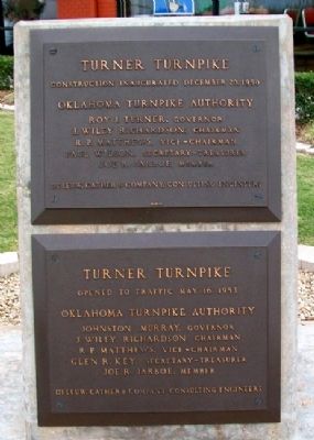
Turner Turnpike
December 20, 1950
Opened to Traffic
May 16, 1953
Erected by Oklahoma Turnpike Authority.
Topics. This historical marker is listed in these topic lists: Charity & Public Work • Roads & Vehicles. A significant historical month for this entry is May 1861.
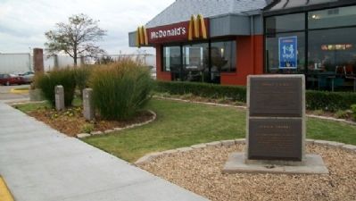
Location. 35° 45.125′ N, 96° 41.325′ W. Marker is near Stroud, Oklahoma, in Lincoln County. Marker is at the I-44 Service Plaza near Milepost 178. Touch for map. Marker is in this post office area: Stroud OK 74079, United States of America. Touch for directions.
Other nearby markers. At least 8 other markers are within 6 miles of this marker, measured as the crow flies. Trooper Kenneth "Kenny" Osborn (here, next to this marker); Trooper Larry Crabtree (here, next to this marker); Murrah Federal Building Bombing (within shouting distance of this marker); William Alfred Mensch Building (approx. 1.9 miles away); Sac & Fox Agency (approx. 1.9 miles away); Stroud Area Veterans Monument (approx. 1.9 miles away); Rock Cafe, Stroud, Oklahoma (approx. 1.9 miles away); Davenport / Davenport Post Office (approx. 5.3 miles away). Touch for a list and map of all markers in Stroud.
Also see . . . History of the Oklahoma Turnpike Authority. (Submitted on September 30, 2012, by William Fischer, Jr. of Scranton, Pennsylvania.)
Credits. This page was last revised on June 16, 2016. It was originally submitted on September 30, 2012, by William Fischer, Jr. of Scranton, Pennsylvania. This page has been viewed 472 times since then and 14 times this year. Photos: 1, 2. submitted on September 30, 2012, by William Fischer, Jr. of Scranton, Pennsylvania.

