Phenix City in Russell County, Alabama — The American South (East South Central)
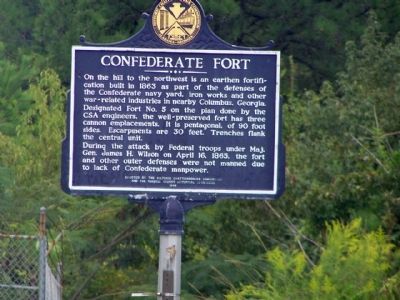
Confederate Fort
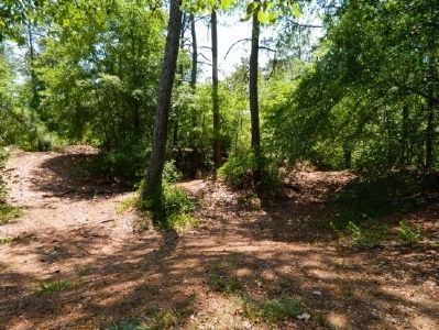
On the hill to the northwest is an earthen fortification built in 1863 as part of the defenses of the Confederate navy yard, iron works and other war-related industries in nearby Columbus, Georgia. Designated Fort No. 5 on the plan done by the CSA engineers, the well-preserved fort has three cannon emplacements. It is pentagonal, of 90 foot sides. Escarpments are 30 feet. Trenches flank the central unit.
During the attack by Federal troops under Major General James H. Wilson on April 16, 1865, the fort and other outer defenses were not manned due to lack of Confederate manpower.
Erected 1988 by The Historic Chattahoochee Commission and the Russell County Historical Commission.
Topics. This historical marker is listed in this topic list: War, US Civil. A significant historical month for this entry is April 1865.
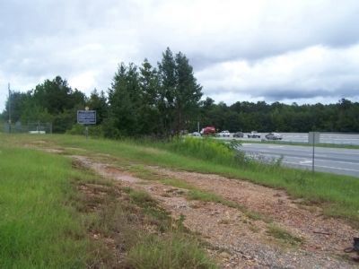
Location. 32° 28.947′ N, 85° 1.876′ W. Marker is in Phenix City, Alabama, in Russell County. Marker is on U.S. 80/280 near Stadium Drive, on the right when traveling south. Touch for map. Marker is in this post office area: Phenix City AL 36867, United States of America. Touch for directions.
Other nearby markers. At least 8 other markers are within 3 miles of this marker, measured as the crow flies. Fort Jabe Brassell (approx. 1.1 miles away); Allen Temple A.M.E. Church / Grant Chapel A.M.E. Church (approx. 1.4 miles away); Union Night Attack Down Summerville Road (approx. 1.4 miles away); Susie E. Allen Elementary School (approx. 1.4 miles away); Albert Love Patterson (approx. 2 miles away); Before The Battle / Battle Of Girard (approx. 2 miles away); Ancient Fisheries (approx. 2.1 miles away); The Tie-Snake (approx. 2.2 miles away). Touch for a list and map of all markers in Phenix City.
Credits. This page was last revised on July 6, 2022. It was originally submitted on October 1, 2012, by Mike Stroud of Bluffton, South Carolina. This page has been viewed 1,917 times since then and 81 times this year. Photos: 1, 2. submitted on October 3, 2012, by Mike Stroud of Bluffton, South Carolina. 3. submitted on May 9, 2014, by Mark Hilton of Montgomery, Alabama.


