Appomattox in Appomattox County, Virginia — The American South (Mid-Atlantic)
After the Surrender
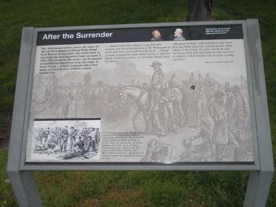
“…shouts sank into silence, every hat was raised, and the bronzed faces of the thousands of grim warriors were bathed with tears… [They] pressed around the noble chief, trying to take his hand, touch his person, or even lay a hand upon his horse…
“The general then, with head bare and tears flowing freely down his manly cheeks, bade adieu to the army. In a few words he told the brave men who had been so true in arms to return to their homes and become worthy citizens.”
- Brig. Gen. Armisted L. Long, CSA
Erected by Appomattox Court House National Historical Park, National Park Service.
Topics. This historical marker is listed in these topic lists: Peace • War, US Civil. A significant historical month for this entry is April 1975.
Location. 37° 22.977′ N, 78° 47.362′ W. Marker is in Appomattox, Virginia, in Appomattox County. Marker is on Old Courthouse Road (Virginia Route 24), on the right when traveling west. The marker is located in Appomattox Court House National Historical Park. Touch for map. Marker is in this post office area: Appomattox VA 24522, United States of America. Touch for directions.
Other nearby markers. At least 8 other markers are within walking distance of this marker. Surrender of the Artillery (here, next to this marker); African American Banjoists (within shouting distance of this marker); Popularizer of the Banjo (within shouting distance of this marker); Artillery Park (within shouting distance of this marker); Appomattox River (about 300 feet away, measured in a direct line); a different marker also named Appomattox River (about 300 feet away); Lee's Apple Tree (about 400 feet away); Grant and Lee Meeting (approx. 0.3 miles away). Touch for a list and map of all markers in Appomattox.
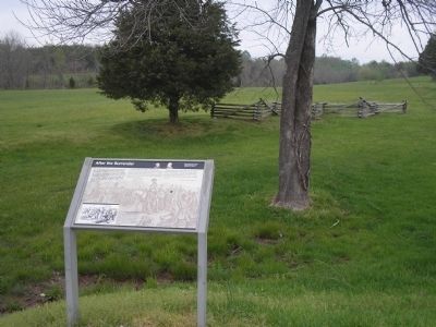
More about this marker. The background of the marker features a picture of Lee on his horse, surrounded by his troops. On the bottom left of the marker is a picture of Union soldiers distributing food to the defeated Confederates. It includes the caption On his return from the village, Lee paused for a time at the orchard before you, waiting for the promised rations from the Federal army to arrive. Then he continued on to his headquarters, his work as army commander done. Meanwhile his army received food (left) from their former enemies – the first food many Confederates had been issued in days.
Also see . . . Appomattox Court House National Historical Park. (Submitted on March 6, 2008, by Bill Coughlin of Woodland Park, New Jersey.)
Credits. This page was last revised on March 21, 2020. It was originally submitted on March 6, 2008, by Bill Coughlin of Woodland Park, New Jersey. This page has been viewed 1,957 times since then and 23 times this year. Photos: 1, 2. submitted on March 6, 2008, by Bill Coughlin of Woodland Park, New Jersey. 3. submitted on April 25, 2010, by Craig Swain of Leesburg, Virginia. 4. submitted on March 6, 2008, by Bill Coughlin of Woodland Park, New Jersey. • Craig Swain was the editor who published this page.


