Christiana in New Castle County, Delaware — The American Northeast (Mid-Atlantic)
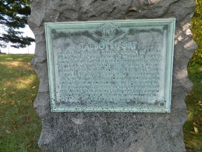
Talbot's Fort
Erected 1933 by Historic Markers Commission.
Topics and series. This historical marker is listed in these topic lists: Colonial Era • Forts and Castles. In addition, it is included in the Delaware Public Archives series list. A significant historical year for this entry is 1684.
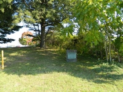
Location. 39° 40.075′ N, 75° 40.033′ W. Marker is in Christiana, Delaware, in New Castle County. Marker is on Christiana Bypass (Delaware Route 273) just west of Brown's Lane. Touch for map. Marker is in this post office area: Newark DE 19702, United States of America. Touch for directions.
Other nearby markers. At least 8 other markers are within walking distance of this marker. Samuel Patterson (approx. 0.2 miles away); Village of Christiana (approx. 0.2 miles away); Christiana United Methodist Church (approx. 0.3 miles away); Old Fort Union American Methodist Episcopal Church (approx. 0.4 miles away); Christiana Presbyterian Church (approx. 0.4 miles away); Christiana Public School #111-C (approx. 0.4 miles away); Lafayette (approx. 0.7 miles away); Last Mustering of The Delaware Continentals (approx. 0.7 miles away). Touch for a list and map of all markers in Christiana.
More about this marker. Enter the Christiana Town Center and turn left to the Red Robin Restaurant. Park nearest Rt 273. Marker is in a clump of trees. There is no parking on 273.
Credits. This page was last revised on February 1, 2020. It was originally submitted on October 5, 2012, by Bill Pfingsten of Bel Air, Maryland. This page has been viewed 1,443 times since then and 85 times this year. Last updated on February 1, 2020, by Carl Gordon Moore Jr. of North East, Maryland. Photos: 1, 2. submitted on October 5, 2012, by Bill Pfingsten of Bel Air, Maryland.

