Solomons in Calvert County, Maryland — The American Northeast (Mid-Atlantic)
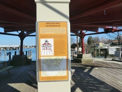
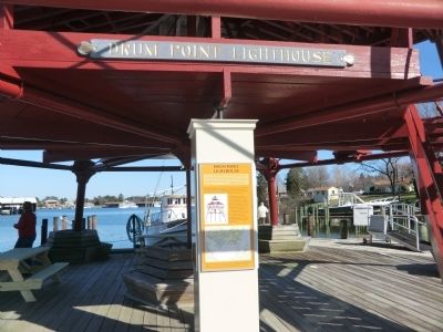
Drum Point Lighthouse
"The necessity of a light at this point is very great, as all vessels bound up or down the Chesapeake put in at this place during the winter to seek protection from floating ice; and as the entrance is formed by a low sand spit, which cannot be seen at night, vessels are often obliged to anchor outside the above mentioned point until daylight, and in consequence, are often driven ashore in heavy and adverse winds."
(Lt. William D. Porter, 1883)
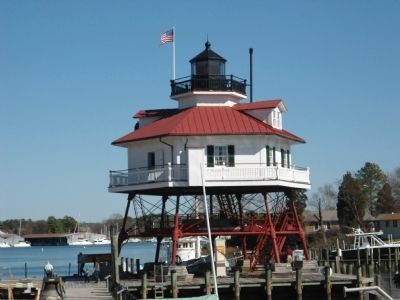
Drum Point Lighthouse was built in 1883 to mark the northern approach to the Patuxent River. It was originally located due south of Drum Point, 120 yards offshore, on five acres of submerged land conveyed by Maryland to the federal government. A white-painted hexagonal wooden structure was built on seven iron screwpiles. All parts were prefabricated and numbered, enabling assembly in only thirty-three days. A fourth-order Fresnel lens was installed and first lit on August 20, 1883, showing a fixed red light. The living quarters contained four equal-size rooms on the first floor-kitchen, sitting room, and two bedrooms. The second floor contained two additional rooms, one housing the bell striking mechanism. Four 200-gallon tanks collected water from the roof.
Topics and series. This historical marker is listed in these topic lists: Communications • Waterways & Vessels. In addition, it is included in the Lighthouses series list. A significant historical year for this entry is 1883.
Location. Marker has been reported permanently removed. It was located near 38° 19.872′ N, 76° 27.804′ W. Marker was in Solomons, Maryland, in Calvert County. Marker was on Solomons Island Road, South. Located on the grounds of the Calvert Marine Museum. Touch for map. Marker was at or near this postal address: 14200 Solomons Island Road, South, Solomons MD 20688, United States of America.
We have been informed that this sign or monument is no longer there and will not be replaced. This page is an archival view of what was.
Other nearby markers. At least 8 other markers are within walking distance of this location. Wm. B. Tennison (here, next to this marker); Welcome to Drum Point Lighthouse (here, next to this marker); Calvert Marine Museum's Dee of St. Mary's (here, next to this marker); The Business End of a Screwpile (here, next to this marker); Power Bateau (a few steps from this marker); a different marker also named Wm. B. Tennison (a few steps from this marker); This flagpole (a few steps from this marker); Sailing Bateau Witch of the Wave (a few steps from this marker). Touch for a list and map of all markers in Solomons.
Related marker. Click here for another marker that is related to this marker. This marker has been replaced by the linked marker.
Also see . . . Drum Point, MD - Lighthouse Friends.com. (Submitted on October 12, 2012, by Bill Pfingsten of Bel Air, Maryland.)
Credits. This page was last revised on September 27, 2020. It was originally submitted on October 11, 2012, by Don Morfe of Baltimore, Maryland. This page has been viewed 513 times since then and 8 times this year. Photos: 1, 2, 3, 4. submitted on October 11, 2012, by Don Morfe of Baltimore, Maryland. • Bill Pfingsten was the editor who published this page.


