Near Sharpsburg in Washington County, Maryland — The American Northeast (Mid-Atlantic)
Smith's Division, Sixth Army Corps
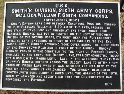
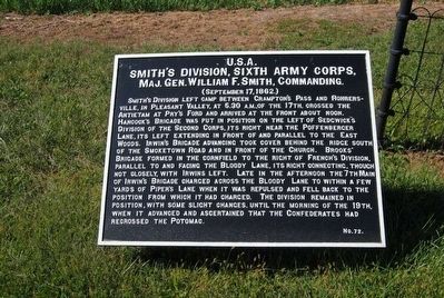
Smith's Division, Sixth Army Corps,
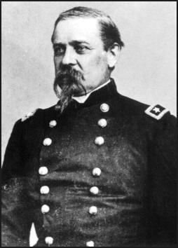
Maj. Gen. William F. Smith, Commanding.
(September 17, 1862.)
Smith's Division left camp between Crampton's Pass and Rohrersville, in Pleasant Valley, at 5:30 a.m., of the 17th, crossed the Antietam at Pry's Ford and arrived at the front about noon. Hancock's Brigade was put in position on the left of Sedgwick's Division of the Second Corps, its right near the Poffenberger Lane, its left extending in front of and parallel to the East Woods. Irwin's Brigade advancing took cover behind the ridge south of the Smoketown Road and in front of the church. Brooks' Brigade formed in the cornfield to the right of French's Division, parallel to and facing the Bloody Lane, its right connecting, though not closely, with Irwins left. Late in the afternoon the 7th Maine of Irwin's Brigade charged across the Bloody Lane to within a few yards of Piper's Lane when it was repulsed and fell back to the position from which it had charged. The division remained in position, with some slight changes, until the morning of the 19th, when it advanced and ascertained that the Confederates had recrossed the Potomac.
Erected by Antietam Battlefield Board. (Marker Number 72.)
Topics and series. This historical marker is listed in this topic list: War, US Civil. In addition, it is included in the Antietam Campaign War Department Markers series list. A significant historical year for this entry is 1862.
Location. 39° 28.777′ N, 77° 44.568′ W. Marker is near Sharpsburg, Maryland, in Washington County. Marker is on Smoketown Road, on the right when traveling west. Touch for map. Marker is in this post office area: Sharpsburg MD 21782, United States of America. Touch for directions.
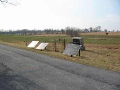
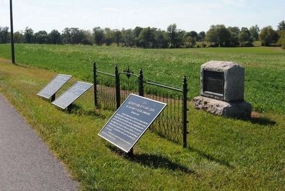
Other nearby markers. At least 8 other markers are within walking distance of this marker. Sixth Army Corps (here, next to this marker); First New Jersey Brigade (here, next to this marker); Slocum's Division, Sixth Army Corps (a few steps from this marker); Jackson's Command (within shouting distance of this marker); Battery D, 2d U.S. Artillery (within shouting distance of this marker); Battery I, 1st U.S. Artillery (within shouting distance of this marker); Batteries A and C 4th U.S. Artillery (within shouting distance of this marker); Battery F, 5th U.S. Artillery (about 400 feet away, measured in a direct line). Touch for a list and map of all markers in Sharpsburg.
Regarding Smith's Division, Sixth Army Corps. This marker is included on the East Woods Virtual Tour by Markers see the Virtual tour link below to see the markers in sequence.
Related markers. Click here for a list of markers that are related to this marker. Smith's Division markers.
Also see . . .
1. Antietam Battlefield. National Park Service site. (Submitted on March 7, 2008, by Craig Swain of Leesburg, Virginia.)
2. 2nd Division, VI Corps. Maj. Gen. W. F. Smith twice lost command of a Corps during the war, yet was noted as providing admirable service during the Antietam, Gettysburg, Chattanooga, and Bermuda Hundred campaigns. (Submitted on March 7, 2008, by Craig Swain of Leesburg, Virginia.)
3. William Farrar Smith. William Farrar Smith (February 17, 1824 – February 28, 1903), known as ‘Baldy’ Smith, was a Union general in the American Civil War, notable for attracting the extremes of glory and blame. (Submitted on October 24, 2015, by Brian Scott of Anderson, South Carolina.)
Photographed By Craig Swain, September 17, 2007
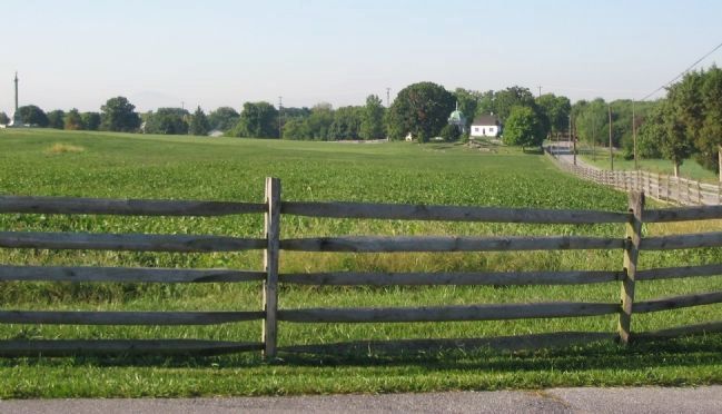
6. Federal Center
Smith's division formed the center of the Federal lines at the conclusion of the morning phase of the battle. Portions of Irwin's Brigade took cover in the low ground beyond the fence here. On the right is the Smoketown Road. The Dunker Church is the white building at the end of the road, standing next to the Hagerstown Pike.

Photographed By Craig Swain, September 17, 2007
7. The Division's Right Flank
Hancock's Brigade formed on the right of the Division's Front and closed upon Sedgwick's Division. Here, from a point in the fields between the Smoketown Road (seen on the right with the utility poles) and Cornfield Avenue (on the left), the marker location is in the copse of trees on the right side of the frame. Hancock's Brigade exited the East Woods directly in front of the camera. Irwin's Brigade was on the right of that, astride and to the south of the Smoketown Road.
NOTE: The location from which this photo was taken is private property (although bounded on all sides by Park ground). The park service periodically gains permission from the owner to conduct guided tours through this area.
NOTE: The location from which this photo was taken is private property (although bounded on all sides by Park ground). The park service periodically gains permission from the owner to conduct guided tours through this area.
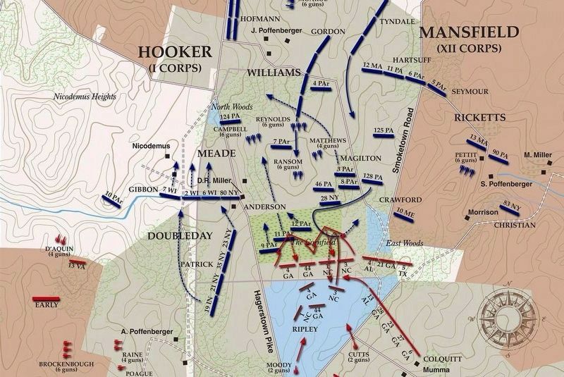
via American Battlefield Trust, unknown
8. East Woods Virtual Tour by Markers.
A collection of markers interpreting the action of during the Battle of Antietam around the East Woods.
(Submitted on March 8, 2008, by Craig Swain of Leesburg, Virginia.)
Click for more information.
(Submitted on March 8, 2008, by Craig Swain of Leesburg, Virginia.)
Click for more information.
Credits. This page was last revised on April 4, 2022. It was originally submitted on March 7, 2008, by Craig Swain of Leesburg, Virginia. This page has been viewed 1,027 times since then and 13 times this year. Photos: 1. submitted on March 7, 2008, by Craig Swain of Leesburg, Virginia. 2. submitted on October 24, 2015, by Brian Scott of Anderson, South Carolina. 3. submitted on March 6, 2008, by Craig Swain of Leesburg, Virginia. 4, 5. submitted on October 24, 2015, by Brian Scott of Anderson, South Carolina. 6. submitted on March 7, 2008, by Craig Swain of Leesburg, Virginia. 7. submitted on March 8, 2008, by Craig Swain of Leesburg, Virginia. 8. submitted on April 4, 2022, by Larry Gertner of New York, New York.
