Near Tonkawa in Kay County, Oklahoma — The American South (West South Central)
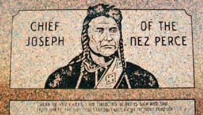
Chief Joseph of the Nez Perce
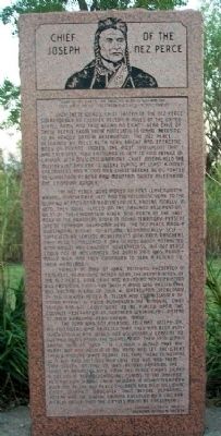
"Hear me my Chiefs, I am tired. My heart is sick and sad. From where the sun now stands, I will fight no more forever."
With these words, Chief Joseph of the Nez Perce surrendered to Colonel Nelson A. Miles of the United States Army and thus began an eight-year exile of these people from their homeland in Idaho. Refusing to be herded onto a reservation, the Nez Perce, described by Miles as "a very bright and energetic body of Indians, indeed, the most intelligent that I had ever seen," fled eastward in 1877 to find refuge in Canada. With only 250 warriors, Chief Joseph held the military at bay for 15 weeks during at least a dozen encounters and a 1700 mile chase before being forced to surrender at Bear Paw Mountain thirty miles from the Canadian border.
The Nez Perce were moved to Fort Levenworth, Kansas, in November 1877, and the following year to the Quapaw Agency near Baxter Springs, Kansas. Finally, in 1879, they were placed on the Oakland Reservation, west of the Chickaskia River and north of the Salt Fork of the Arkansas River in Indian Territory, present site of Tonkawa, Oklahoma. Here, the Nez Perce made a substantial effort to become economically self-sufficient by leasing agreements with area ranchers. They also established a Day School which attracted both adults and children. Nevertheless, the Nez Perce could not be acclimated. The death rate was abnormally high, and they continued to seek a return to their homeland.
Finally in May of 1884, petitions presented in Congress, demanding action upon the repatriation of the Nez Perce, bore fruit and the Indian Appropriation Bill providing funds for such a move was passed. The Bill became a law on July 4, whereupon Secrety of the Interior Henry M. Teller and Commissioner of Indian Affairs H. Price authorized the removal. Chief Joseph and his group where to be placed upon the Colville Reservation in Northern Washington instead of their homeland near Lapwai, Idaho.
The plan was not pleasing to Chief Joseph or his followers who objected that they had been punished enough and would not voluntarily consent to further humiliation. The segregation, they said, would brand them as "wild". "If I could, I would take my heart out and hold it in my hand and let the Great Father and the White People see that there is nothing in it but kind feelings and love for him and them," said Chief Joseph on May 22, 1885. Before boarding the train at Arkansas City, four Nez Perce Chiefs signed a document relinquishing all claims to the Oakland Reservation. During their sojourn in Indian Territory over 100 of the Nez Perce children had died, including Chief Joseph's daughter. Thus before departing, Joseph had the burial ground enclosed
by a log barrier in order that the graves might be preserved.
Erected by Tonkawa Historical Society and Oklahoma Historical Society.
Topics and series. This historical marker is listed in this topic list: Native Americans. In addition, it is included in the Oklahoma Historical Society, and the The Nez Perce Trail series lists. A significant historical month for this entry is May 1884.
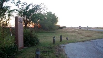
Location. 36° 41.285′ N, 97° 16.02′ W. Marker is near Tonkawa, Oklahoma, in Kay County. Marker is on U.S. 60/177, on the right when traveling east. Marker is at a roadside pullout off the eastbound lanes. Touch for map. Marker is in this post office area: Tonkawa OK 74653, United States of America. Touch for directions.
Other nearby markers. At least 8 other markers are within 9 miles of this marker, measured as the crow flies. Camp Tonkawa (approx. 2 miles away); Oklahoma Baptist College (approx. 7.9 miles away); Homesteaders (approx. 7.9 miles away); 100 Beautiful Years (approx. 7.9 miles away); Blackwell Zinc Company WWII Memorial (approx. 7.9 miles away); 101 Dairy Barn Vent from Dairy Barn (approx. 8.8 miles away); Two Old Potato Plows (approx. 8.8 miles away); "White House" (approx. 8.8 miles away).
Also see . . .
1. Chief Joseph. (Submitted on October 21, 2012, by William Fischer, Jr. of Scranton, Pennsylvania.)
2. Nez Perce Tribe. (Submitted on October 21, 2012, by William Fischer, Jr. of Scranton, Pennsylvania.)
3. Nez Perce National Historical Park. (Submitted on October 21, 2012, by William Fischer, Jr. of Scranton, Pennsylvania.)
4. Nez Perce National Historic Trail. (Submitted on October 21, 2012, by William Fischer, Jr. of Scranton, Pennsylvania.)

Photographed By Allen C. Browne, February 16, 2015
4. Chief Joseph
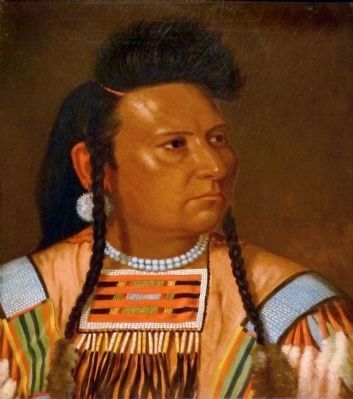
This 1878 painting of Chief Joseph by Cyrenius Hall hangs in the National Portrait Gallery in Washington, DC.
“Chief Joseph came to embody for many the tragic plight of Native Americans during the second half of the nineteenth century … His resistance to government efforts to move the Nez Perce people to a reservation drew anger from U.S. authorities, but also prompted widespread sympathy from many Americans. When troops were called in to speed the removal process in 1877, Joseph and 800 of his followers began a strategic retreat, seeking safety first among allied tribes in Montana and then heading toward Canada. Only thirty miles from the border, a command led by General Nelson Miles intercepted this band and forced Joseph to surrender. For the next eight years Joseph was imprisoned at several sites, including Fort Leavenworth in Kansas. It was there that artist Cyrenius Hall created this painting of the dispirited leader.” — National Portrait Gallery
“Chief Joseph came to embody for many the tragic plight of Native Americans during the second half of the nineteenth century … His resistance to government efforts to move the Nez Perce people to a reservation drew anger from U.S. authorities, but also prompted widespread sympathy from many Americans. When troops were called in to speed the removal process in 1877, Joseph and 800 of his followers began a strategic retreat, seeking safety first among allied tribes in Montana and then heading toward Canada. Only thirty miles from the border, a command led by General Nelson Miles intercepted this band and forced Joseph to surrender. For the next eight years Joseph was imprisoned at several sites, including Fort Leavenworth in Kansas. It was there that artist Cyrenius Hall created this painting of the dispirited leader.” — National Portrait Gallery
Credits. This page was last revised on September 24, 2020. It was originally submitted on October 21, 2012, by William Fischer, Jr. of Scranton, Pennsylvania. This page has been viewed 1,677 times since then and 48 times this year. Photos: 1, 2, 3. submitted on October 21, 2012, by William Fischer, Jr. of Scranton, Pennsylvania. 4. submitted on May 25, 2015, by Allen C. Browne of Silver Spring, Maryland.


