Sutherland in Dinwiddie County, Virginia — The American South (Mid-Atlantic)
Sutherland Station
Confederate Defense Crumbles
— Lee’s Retreat —
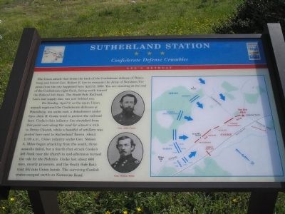
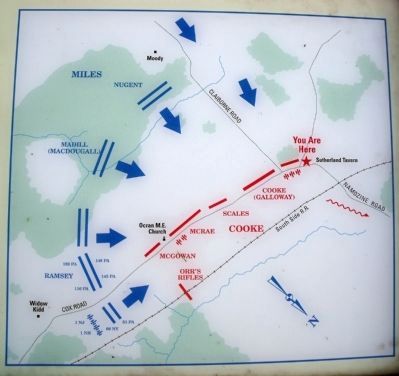
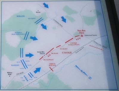
On Sunday, April 2, as the main Union assault ruptured the Confederate defenses at Petersburg, ten miles east, a detachment under Gen. John R. Cooke tried to protect the railroad here. Cooke’s thin infantry line stretched from this point east along the road for almost a mile to Ocran Church, while a handful of artillery was posted here next to Sutherland Tavern. About 11:00 a.m., Union infantry under Gen. Nelson A. Miles began attacking from the south; three assaults failed, but a fourth that struck Cooke’s left flank near the church in mid-afternoon turned the tide for the Federals. Cooke lost about 600 men, mostly prisoners, and the South Side Railroad fell into Union hands. The surviving Confederates escaped north on Namozine Road.
Erected by Virginia Civil War Trails.
Topics and series. This historical marker is listed in this topic list: War, US Civil. In addition, it is included in the Virginia Civil War Trails series list. A significant historical month for this entry is April 1790.
Location. 37° 11.818′ N, 77° 33.89′ W. Marker is in Sutherland, Virginia, in Dinwiddie County. Marker is at the intersection of Namozine Road (Virginia Route 708) and Cox Road (U.S. 460), on the left on Namozine Road. Touch for map. Marker is in this post office area: Sutherland VA 23885, United States of America. Touch for directions.
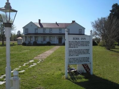
Other nearby markers. At least 8 other markers are within 4 miles of this marker, measured as the crow flies. A different marker also named Sutherland Station (here, next to this marker); The Battle of Sutherland (a few steps from this marker); Fork Inn (about 300 feet away, measured in a direct line); Engagement at Sutherland Station (about 600 feet away); Appomattox Campaign (Sutherland Station) (about 700 feet away); Rocky Branch School (approx. 0.7 miles away); Col. John Banister (approx. 1.2 miles away); The Battle of White Oak Road (approx. 3.2 miles away). Touch for a list and map of all markers in Sutherland.
More about this marker. The marker features a battle map on the right, and photos of Confederate Gen. John Cooke and Union Gen. Nelson Miles.
Also see . . .
1. Lee's Retreat to Appomattox. (Submitted on March 8, 2008, by Bill Coughlin of Woodland Park, New Jersey.)
2. Lee’s Retreat. (Submitted on March 12, 2008, by Bill Coughlin of Woodland Park, New Jersey.)
3. The Battle of Sutherland’s Station. The American Civil War website. (Submitted on January 22, 2009, by Bill Coughlin of Woodland Park, New Jersey.)
Credits. This page was last revised on August 26, 2020. It was originally submitted on March 8, 2008. This page has been viewed 2,098 times since then and 27 times this year. Last updated on August 24, 2020, by Bradley Owen of Morgantown, West Virginia. Photos: 1. submitted on March 8, 2008, by Bill Coughlin of Woodland Park, New Jersey. 2. submitted on May 11, 2009, by Bernard Fisher of Richmond, Virginia. 3, 4, 5. submitted on March 8, 2008, by Bill Coughlin of Woodland Park, New Jersey. • J. Makali Bruton was the editor who published this page.
