Marker Logo HMdb.org THE HISTORICAL
MARKER DATABASE
“Bite-Size Bits of Local, National, and Global History”
Shorter in Macon County, Alabama — The American South (East South Central)
 

George Stiggins

1788-1845


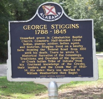
George Stiggins Marker image. Click for full size.
Photographed By Mike Stroud, September 12, 2012
1. George Stiggins Marker
Inscription. Unmarked grave in Cubahatchie Baptist Church Cemetery. Half-blooded Creek Indian, planter, soldier, Indian agent, and historian, Stiggins lived on a nearby farm fronting the Federal Road from 1831 until his death. There he wrote "A Historical Narrative of the Genealogy, Traditions, and Downfall of the Ispocoga or Creek Indian Tribe of Indians" from his firsthand knowledge of the Creeks, their leaders, and the Creek War of 1813-14. His sister, Mary, was married to William Weatherford (Red Eagle).
 
Erected 1990 by Alabama Historical Association.
 
Topics and series. This historical marker is listed in these topic lists: EducationNative Americans. In addition, it is included in the Alabama Historical Association series list. A significant historical year for this entry is 1831.
 
Location. 32° 23.669′ N, 85° 55.494′ W. Marker is in Shorter, Alabama, in Macon County. Marker is on Old Federal Road (County Road 8), on the right when traveling west. Touch for map. Marker is at or near this postal address: 1060 Old Federal Road, Shorter AL 36075, United States of America. Touch for directions.
 
Other nearby markers. At least 8 other markers are within 9 miles of this marker, measured as the crow flies. Shorter, Alabama (approx. 0.2 miles away); Pioneer Trail of Methodism (approx. 3.1 miles away); Prairie Farms Resettlement Community
Paid Advertisement
Click on the ad for more information.
Please report objectionable advertising to the Editor.
Click or scan to see
this page online
(approx. 3.9 miles away); Tukabatchee / Tokvpvcce (approx. 6 miles away); Lucas Tavern (approx. 7.1 miles away); The Oaks Plantation (approx. 7˝ miles away); Lucas Hill Cemetery (approx. 7.6 miles away); Brewer Memorial Church (approx. 8.1 miles away). Touch for a list and map of all markers in Shorter.
 
Also see . . .  Wikipedia article on the Creek War. (Submitted on June 28, 2016, by Mark Hilton of Montgomery, Alabama.)
 
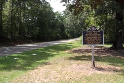
George Stiggins Marker, along Old Federal Road (County Road 8) looking west image. Click for full size.
Photographed By Mike Stroud, September 12, 2012
2. George Stiggins Marker, along Old Federal Road (County Road 8) looking west
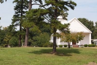
George Stiggins, as mentioned, Cubahatchie Baptist Church and Cemetery, today image. Click for full size.
Photographed By Mike Stroud, September 12, 2012
3. George Stiggins, as mentioned, Cubahatchie Baptist Church and Cemetery, today
 
 
Credits. This page was last revised on June 28, 2016. It was originally submitted on October 25, 2012, by Mike Stroud of Bluffton, South Carolina. This page has been viewed 1,405 times since then and 65 times this year. Photos:   1, 2, 3. submitted on October 27, 2012, by Mike Stroud of Bluffton, South Carolina.
Share this page.  
Share on Tumblr
m=60534

CeraNet Cloud Computing sponsors the Historical Marker Database.
This website earns income from purchases you make after using our links to Amazon.com. We appreciate your support.
Paid Advertisement
Apr. 23, 2024