Champs-Élysées in Paris in Département de Paris, Île-de-France, France — Western Europe
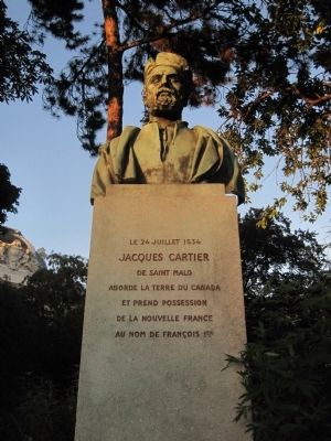
Jacques Cartier
le 24 juillet 1534
[English translation]
On July 24, 1534 Jacques Cartier of Saint Malo Discovers the land of Canada and takes possession of New France in the name of France.
Topics. This historical marker is listed in this topic list: Exploration. A significant historical date for this entry is July 24, 1534.
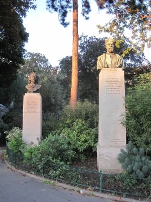
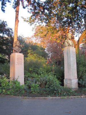
Location. 48° 51.902′ N, 2° 18.634′ E. Marker is in Paris, Île-de-France, in Département de Paris. It is in Champs-Élysées. Marker is at the intersection of Cours la Reine and Avenue de Franklin Delano Roosevelt on Cours la Reine. This marker is located at the entrance to l'jardin de la Nouveau Monde (Garden of the New World). Touch for map. Marker is in this post office area: Paris, Île-de-France 75008, France. Touch for directions.
Other nearby markers. At least 8 other markers are within walking distance of this marker. Samuel Champlain (here, next to this marker); Conrad Busken Huet (approx. 0.4 kilometers away); André Dhôme (approx. half a kilometer away); Gabriel Masse (approx. half a kilometer away); René Alazard (approx. half a kilometer away); The Conference Gate (approx. 0.6 kilometers away); L’égoùt de Paris (approx. 0.7 kilometers away); Jean Giraudoux (approx. 0.7 kilometers away). Touch for a list and map of all markers in Paris.
Also see . . . Jaques Cartier - Dictonary of Canadian Biography Online . "CARTIER, JACQUES, navigator of Saint-Malo, first explorer of the Gulf of St. Lawrence in 1534, discoverer of the St. Lawrence River in 1535, commander of the settlement of Charlesbourg-Royal in 1541–42." (Submitted on October 25, 2012, by Barry Swackhamer of Brentwood, California.)
Credits. This page was last revised on January 30, 2023. It was originally submitted on October 25, 2012, by Barry Swackhamer of Brentwood, California. This page has been viewed 478 times since then and 6 times this year. Photos: 1, 2, 3. submitted on October 25, 2012, by Barry Swackhamer of Brentwood, California. • Bill Pfingsten was the editor who published this page.


