Mannboro in Amelia County, Virginia — The American South (Mid-Atlantic)
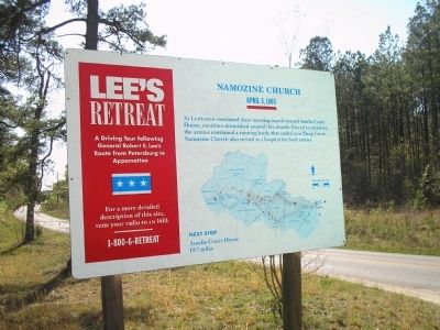
Namozine Church
Lee's Retreat
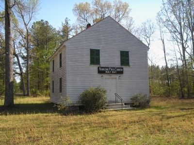
As Lee's men continued their morning march toward Ameila Court House, cavalries skirmished around this church. Forced to withdraw, the armies continued a running battle that ended near Deep Creek. Namozine Church also served as a hospital for both armies.
Next Stop
Amelia Court House 19.7 miles.
Erected by Virginia's Retreat.
Topics. This historical marker is listed in this topic list: War, US Civil. A significant historical month for this entry is April 1814.
Location. 37° 14.956′ N, 77° 43.523′ W. Marker is in Mannboro, Virginia, in Amelia County. Marker is at the intersection of Mill Quarter Road (County Route 622) and Namozine Road (County Route 708), on the left when traveling north on Mill Quarter Road. Touch for map. Marker is in this post office area: Mannboro VA 23105, United States of America. Touch for directions.
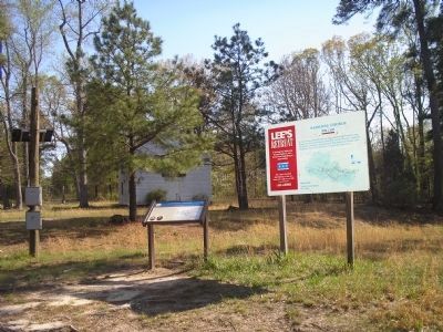
Other nearby markers. At least 8 other markers are within 9 miles of this marker, measured as the crow flies. A different marker also named Namozine Church (here, next to this marker); Lee’s Retreat (here, next to this marker); William Ransom Johnson (approx. 5.2 miles away); Eppington (approx. 5˝ miles away); Battle of Five Forks (approx. 6˝ miles away); Ford's Depot (approx. 6.9 miles away); Piney Grove Church Meeting Site (approx. 7.6 miles away); Clover Hill Mining District (approx. 8.2 miles away). Touch for a list and map of all markers in Mannboro.
More about this marker. Below the main text of the marker is a map of the retreat showing important stops along the route.
Regarding Namozine Church. Part of a driving tour following General Robert E. Lee's route from Petersburg to Appomattox. While visiting the site a more detailed description is played on short range radio on AM1610. Or call 1-800-6-retreat.
Also see . . .
1. Lee's Retreat to Appomattox. (Submitted on March 9, 2008, by Bill Coughlin of Woodland Park, New Jersey.)
2. Lee's Retreat. (Submitted on March 9, 2008, by Bill Coughlin of Woodland Park, New Jersey.)
Credits. This page was last revised on June 16, 2016. It was originally submitted on March 9, 2008, by Bill Coughlin of Woodland Park, New Jersey. This page has been viewed 1,784 times since then and 25 times this year. Photos: 1, 2, 3. submitted on March 9, 2008, by Bill Coughlin of Woodland Park, New Jersey. • Craig Swain was the editor who published this page.


