Windsor in Bertie County, North Carolina — The American South (South Atlantic)
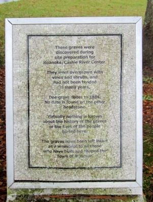
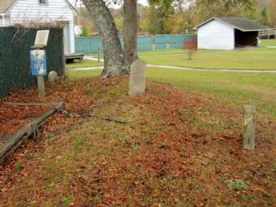
Roanoke/Cashie River Center Grave Site
One grave dates to 1884. No date is found on the other headstone.
Virtually nothing is known about the history of the graves or the history of the people buried here.
The graves have been left intact as a memorial to all those who have built and shaped the Town of Windsor.
Topics. This historical marker is listed in this topic list: Cemeteries & Burial Sites. A significant historical year for this entry is 1884.
Location. 35° 59.528′ N, 76° 56.645′ W. Marker is in Windsor, North Carolina, in Bertie County. Marker can be reached from West Water Street (U.S. 17) near Sutton Drive, on the left when traveling west. Located at the Roanoke/Cashie River Center. Touch for map. Marker is at or near this postal address: 112 West Water Street, Windsor NC 27983, United States of America. Touch for directions.
Other nearby markers. At least 8 other markers are within walking distance of this marker. Eden House Root Cellar (within shouting distance of this marker); Wellington and Powell Railroad (within shouting distance of this marker); Engagement at Windsor (within shouting distance of this marker); WWII POW Camp (about 400 feet away, measured in a direct line); Gray’s Landing (about 800 feet away); Historic Windsor (approx. 0.2 miles away); The Battle of Windsor (approx. 0.2 miles away); William Blount (approx. ¼ mile away). Touch for a list and map of all markers in Windsor.
Credits. This page was last revised on February 22, 2021. It was originally submitted on October 30, 2012, by Bernard Fisher of Richmond, Virginia. This page has been viewed 652 times since then and 22 times this year. Photos: 1, 2. submitted on October 30, 2012, by Bernard Fisher of Richmond, Virginia.

