Sierra Blanca in Hudspeth County, Texas — The American South (West South Central)
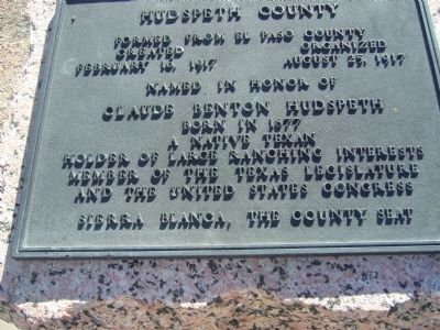
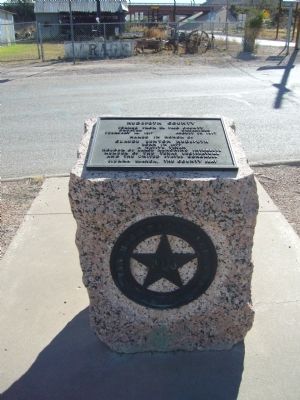
Hudspeth County
Created February 16, 1917
Organized August 25, 1917
Named in honor of
Claude Benton Hudspeth
Born in 1877
A native Texan
Holder of larger ranching interests
Member of the Texas Legislature
and the United States Congress
Sierra Blanca, the county seat
Erected 1936 by Texas Highway Department. (Marker Number 2590.)
Topics and series. This historical marker is listed in this topic list: Settlements & Settlers. In addition, it is included in the Texas 1936 Centennial Markers and Monuments series list. A significant historical date for this entry is February 16, 1917.
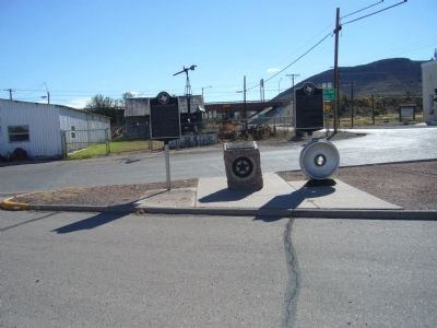
Location. 31° 10.477′ N, 105° 21.443′ W. Marker is in Sierra Blanca, Texas, in Hudspeth County. Marker is at the intersection of Sierra Blanca Avenue (Ranch to Market Road 1111) and El Paso Street (Business Interstate 10), on the right when traveling north on Sierra Blanca Avenue. Touch for map. Marker is in this post office area: Sierra Blanca TX 79851, United States of America. Touch for directions.
Other nearby markers. At least 7 other markers are within 9 miles of this marker, measured as the crow flies. America's Second Transcontinental Railroad (here, next to this marker); The Killing of General J. J. Byrne (here, next to this marker); Sierra Blanca Methodist Church (approx. 0.2 miles away); Fort Quitman (approx. 0.4 miles away); Hudspeth County Courthouse (approx. 0.4 miles away); August Fransal (approx. 0.6 miles away); Claude Hudspeth (approx. 8˝ miles away).
Also see . . . Hudspeth County - The Handbook of Texas Online. Texas State Historical Association (TSHA) (Submitted on June 13, 2018, by Brian Anderson of Humble, Texas.)
Credits. This page was last revised on June 13, 2018. It was originally submitted on October 31, 2012, by Bill Kirchner of Tucson, Arizona. This page has been viewed 431 times since then and 22 times this year. Last updated on June 4, 2018, by Brian Anderson of Humble, Texas. Photos: 1, 2, 3. submitted on October 31, 2012, by Bill Kirchner of Tucson, Arizona. • Bill Pfingsten was the editor who published this page.


