Comer in Barbour County, Alabama — The American South (East South Central)
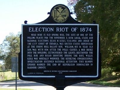
Election Riot of 1874
Erected 1979 by Historic Chattahoochee Commission.
Topics. This historical marker is listed in this topic list: Government & Politics. A significant historical month for this entry is November 1796.
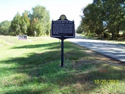
Location. 32° 2.071′ N, 85° 22.919′ W. Marker is in Comer, Alabama, in Barbour County. Marker is on U.S. 82 just west of Silo Road, on the right when traveling east. Near County Road 49. Touch for map. Marker is in this post office area: Midway AL 36053, United States of America. Touch for directions.
Other nearby markers. At least 8 other markers are within 9 miles of this marker, measured as the crow flies. Spring Hill United Methodist Church (approx. 4.1 miles away); Braxton Bragg Comer (approx. 4.1 miles away); Providence Methodist Church & Schoolhouse (approx. 4.3 miles away); Fort Browder / 15th Alabama Infantry (approx. 4.3 miles away); a different marker also named Fort Browder / 15th Alabama Infantry (approx. 4.6 miles away); Batesville Church - 1837 (approx. 4.6 miles away); Ramah Baptist Church & Cemetery (approx. 5 miles away); Jefferson Davis Highway (approx. 8˝ miles away).
Also see . . . Election Riots of 1874. An article from the online Encyclopedia of Alabama. (Submitted on May 20, 2021, by Laura Hill of Auburn, Alabama.)
Credits. This page was last revised on May 20, 2021. It was originally submitted on November 5, 2012, by David J Gaines of Pinson, Alabama. This page has been viewed 1,745 times since then and 98 times this year. Photos: 1, 2. submitted on November 5, 2012, by David J Gaines of Pinson, Alabama. • Bill Pfingsten was the editor who published this page.

