Surrey in Greater Vancouver, British Columbia — Canada’s West Coast (North America)
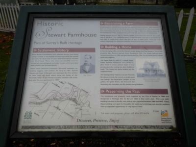
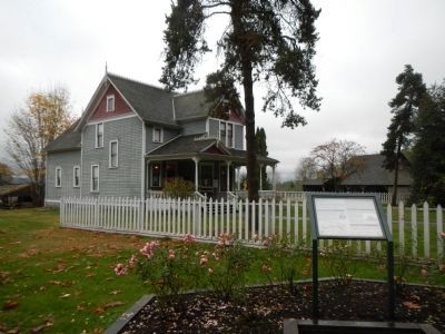
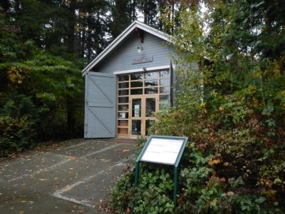
Historic Stewart Farmhouse
Part of Surrey’s Built Heritage
Inscription.
Settlement History
First Nations settlements and seasonal hunting and fishing camps existed at the mouths of rivers and along the coastal shoreline for thousands of years before Europeans reached the West Coast. These sites were near plentiful resources of fish, berries, wild game and cedar forests, which provided food, shelter and transportation.
These same resources eventually attracted explorers, fur traders, loggers, and settlers. As early as 1861, Samuel Handy and Hugh McDougall were among the first settlers to clear land and build cabins along the banks of the Nicomekl River. It was Handy’s quarter section (120 acres) that John Stewart purchased in 1880.
Establishing a Farm
Establishing a successful farm was the first priority of early settlers. John Steward had two tracks of land on the north side of the Nicomekl River. The farm fields were reached by row boat or by crossing the river at Elgin and then by following the Semiahmoo Trail. A prosperous grain and hay operation was established.
During harvest seasons, the S.S. Grainer loaded grain from the dock on the north side of the river. The steamship drew 12 feet of water and had to be loaded at high tide. It could carry about 200 tons of hay. In later years, when the road system improved, the Stewarts sold hay directly from their own barns.
Building a Home
A two-storey log cabin served the Stewart family during their first decade of life on this property. John Stewart married Annie Davidson in 1884. The couple had two sons, William James born in 1885, and John Massey born in 1890. As the family grew, a larger home was required.
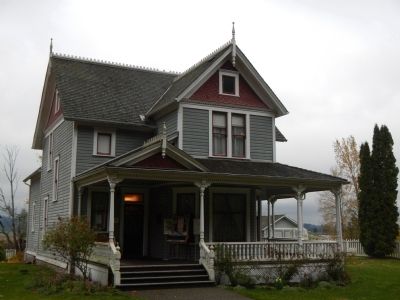
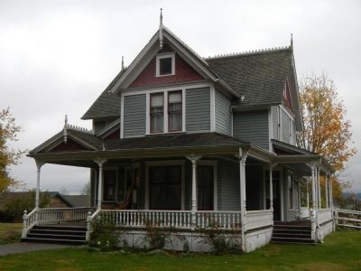
The house built in 1894 is a typical Fraser Valley Victorian farmhouse. It is similar to plans found in house pattern books of the period, generally costing less than $2,000 to build. This house was quite modest for the neighbourhood.
The distinguishing features of a late Victorian farmhouse include the turned verandah posts and railing, the decorative shingles in the gables, the gable finials, the fretwork that decorates the verandah, and the double-hung windows.
Preserving the Past
The farmhouse and property were acquired by the City of Surrey in 1984 and designated a Heritage Site by By-Law 7823 in that same year. They are eight buildings covered by the By-Law, and all were restored between 1988 and 1993. Today, these buildings are open to public for tours and workshops and provide residents with an enjoyable opportunity to step back in time.
Erected 2004 by Surrey Parks, Recreation & Culture.
Topics. This historical marker is listed in these topic lists:
Agriculture • Settlements & Settlers. A significant historical year for this entry is 1861.
Location. 49° 3.895′ N, 122° 50.53′ W. Marker is in Surrey, British Columbia, in Greater Vancouver. Marker can be reached from Crescent Road. Touch for map. Marker is at or near this postal address: 13723 Crescent Road, Surrey BC V4P 1J4, Canada. Touch for directions.
Other nearby markers. At least 8 other markers are within 16 kilometers of this marker, measured as the crow flies. Farming History (a few steps from this marker); Historic Elgin (approx. 1.1 kilometers away); Historic Port Elgin (approx. 1.3 kilometers away); The Semiahmoo Trail (approx. 1.3 kilometers away); Historic McMillan Expedition (approx. 3.4 kilometers away); Peace Arch (approx. 9.4 kilometers away); Salmon! (approx. 13.5 kilometers away); The New Westminster Court House and Land Registry Office (approx. 16.2 kilometers away). Touch for a list and map of all markers in Surrey.
Credits. This page was last revised on June 16, 2016. It was originally submitted on November 6, 2012, by Barry Swackhamer of Brentwood, California. This page has been viewed 840 times since then and 45 times this year. Photos: 1, 2, 3, 4, 5. submitted on November 6, 2012, by Barry Swackhamer of Brentwood, California. • Syd Whittle was the editor who published this page.
