Near Sharpsburg in Washington County, Maryland — The American Northeast (Mid-Atlantic)
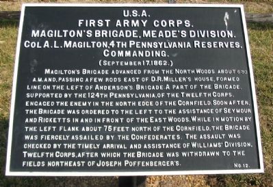
First Army Corps
Magilton's Brigade, Meade's Division
First Army Corps.
Magilton's Brigade, Meade's Division.
Col A.L. Magilton, 4th Pennsylvania Reserves,
Commanding.
(September 17, 1862.)
Magilton's Brigade advanced from the North Woods about 6:30 a.m. and, passing a few yards east of D.R. Miller's House, formed line on the left of Anderson's Brigade. A part of the Brigade, supported by the 124th Pennsylvania, of the Twelfth Corps, engaged the enemy in the north edge of the Cornfield. Soon after, the Brigade was ordered to the left to the assistance of Seymour and Ricketts in and in front of the East Woods. While in motion by the left flank about 75 feet north of the Cornfield, the Brigade was fiercely assailed by the Confederates. The assault was checked by the timely arrival and assistance of Williams' Division, Twelfth Corps, after which the Brigade was withdrawn to the fields northeast of Joseph Poffenberger's.
Erected by Antietam Battlefield Board. (Marker Number 12.)
Topics and series. This historical marker is listed in this topic list: War, US Civil. In addition, it is included in the Antietam Campaign War Department Markers series list. A significant historical date for this entry is September 17, 1862.
Location. 39° 28.966′ N, 77° 44.945′ W. Marker is near Sharpsburg, Maryland, in Washington County. Marker is on Dunker Church Road / Old Hagerstown Pike, on the right when traveling north. Located just south of the D.R. Miller Farm House. Touch for map. Marker is in this post office area: Sharpsburg MD 21782, United States of America. Touch for directions.
Other nearby markers. At least 10 other markers are within walking distance of this marker. A different marker also named First Army Corps (within shouting distance of this marker); Battery B, 4th U.S. Artillery (within shouting distance of this marker); Doubleday's Division, First Army Corps (about 300 feet away, measured in a direct line); Twelfth Army Corps (about 300 feet away); Battery B, 4th United States Artillery (about 300 feet away); a different marker also named Doubleday's Division, First Army Corps (about 600 feet away); a different marker also named Twelfth Army Corps (about 600 feet away); Battery C, 5th U.S. Artillery (about 600 feet away); 13th New Jersey Infantry (about 600 feet away); Indiana State Monument (about 700 feet away). Touch for a list and map of all markers in Sharpsburg.
Related markers. Click here for a list of markers that are related to this marker. Magilton's Brigade Tablets
Also see . . .
1. Antietam Battlefield. National Park Service site. (Submitted on March 9, 2008, by Craig Swain of Leesburg, Virginia.)
2. 2nd Brigade, 3rd Division, I Corps. Magilton's Brigade was one of Meade's Division of Pennsylvania Reserves. (Submitted on March 9, 2008, by Craig Swain of Leesburg, Virginia.)
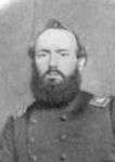
3. Col. Albert Lewis Magilton. (Submitted on October 25, 2015, by Brian Scott of Anderson, South Carolina.)
4. Col. Albert Lewis Magilton Official Report. (Submitted on October 25, 2015, by Brian Scott of Anderson, South Carolina.)
Additional commentary.
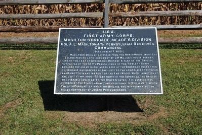
1. Out of Place Tablet
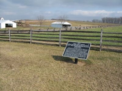
The location of this tablet seems to be out of place, referencing action that took place nearly a quarter-mile away, closer to Mansfield Avenue. This illustrates one of the complications of the study of the battle, particularly when using the War Department tablets as guides. Since the battlefield was originally little more than right of ways through the farm lands, those erecting monuments and markers did not have access to the precise point where a particular unit fought. Instead, the inscriptions often mention distances and directions away from the markers to key the reader.
— Submitted March 9, 2008, by Craig Swain of Leesburg, Virginia.
Photographed By Craig Swain, February 9, 2008
3. Magilton's Brigade Tablet
The field behind the tablet is the historical cornfield. Following the fence line extending diagonally in the distance past the Miller farm buildings, Magilton's Brigade originally fronted the fence about half way across the field, facing south.
Photographed By Craig Swain, September 17, 2007
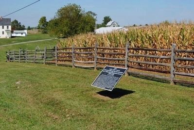
6. The "Hot Corner" of the Cornfield
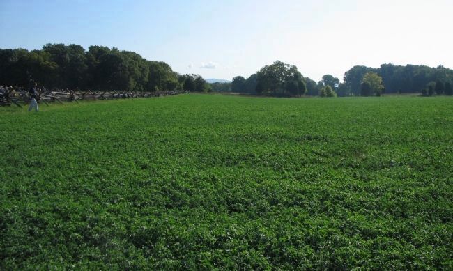
The northeast corner of the cornfield was heavily contested during the morning phase of the battle. The Brigade originally fronted the fence line on the left. In order to close upon Ricketts' Division in the East Woods (which stood in the distance beyond the green field), the Brigade had to shift left and change facing. The Brigade was in the process of changing orientation, moving by the left flank to face west or southwest, when part of Law's Confederate Brigade attacked.
Credits. This page was last revised on September 29, 2017. It was originally submitted on March 9, 2008, by Craig Swain of Leesburg, Virginia. This page has been viewed 839 times since then and 15 times this year. Photos: 1. submitted on March 9, 2008, by Craig Swain of Leesburg, Virginia. 2. submitted on October 25, 2015, by Brian Scott of Anderson, South Carolina. 3. submitted on March 9, 2008, by Craig Swain of Leesburg, Virginia. 4, 5. submitted on October 25, 2015, by Brian Scott of Anderson, South Carolina. 6. submitted on March 9, 2008, by Craig Swain of Leesburg, Virginia.
