Near Coupeville in Island County, Washington — The American West (Northwest)
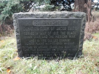
Sunnyside
Donation claim of Jacob Ebey.
Served in War of 1812, the Black Hawk War and the Mexican War.
When 61 yrs old led company across plains with covered wagons.
Settled on Whidbey Island and built this home, four blockhouses and stockade in 1856
Given in honor of Co. Ebey, his descendants and early settlers.
Topics. This historical marker is listed in these topic lists: Settlements & Settlers • War of 1812 • War, Mexican-American • Wars, US Indian. A significant historical year for this entry is 1812.
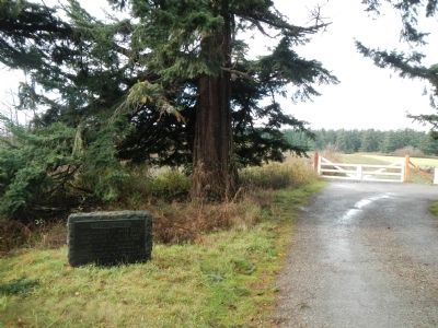
Location. 48° 12.273′ N, 122° 42.421′ W. Marker is near Coupeville, Washington, in Island County. Marker is on Cemetery Road. This marker is at the end of Cemetery Road where the road becomes private and is gated. Touch for map. Marker is in this post office area: Coupeville WA 98239, United States of America. Touch for directions.
Other nearby markers. At least 8 other markers are within 2 miles of this marker, measured as the crow flies. A Bold New Idea (about 400 feet away, measured in a direct line); Mary Barrett (about 600 feet away); Davis Blockhouse (about 600 feet away); Remaining Blockhouses of Central Whidbey (about 600 feet away); Ebey Blockhouse (approx. ¼ mile away); Central Whidbey Historic District (approx. 1.3 miles away); Douglas Fir Log (approx. 1.3 miles away); Methodist Episcopal Church Foundation Stone (approx. 1.3 miles away). Touch for a list and map of all markers in Coupeville.
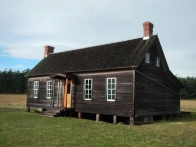
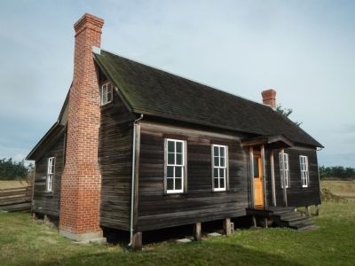
Also see . . . Jacob Ebey House _ Ebey's Forever. The house was built in 1855 by Jacob Ebey, father of Isaac Ebey. Isaac staked his donation land claim on Ebey's Prairie in 1850, and that swath of land from Ebey's Landing back to Cook Road still looks much like it did 160 years ago. (Submitted on November 10, 2012, by Barry Swackhamer of Brentwood, California.)
Credits. This page was last revised on December 28, 2019. It was originally submitted on November 10, 2012, by Barry Swackhamer of Brentwood, California. This page has been viewed 441 times since then and 8 times this year. Photos: 1, 2, 3, 4. submitted on November 10, 2012, by Barry Swackhamer of Brentwood, California. • Syd Whittle was the editor who published this page.


