Near Dickens in Allegany County, Maryland — The American Northeast (Mid-Atlantic)
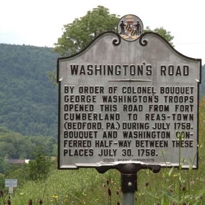
Washington’s Road
Erected by State Roads Commission.
Topics and series. This historical marker is listed in these topic lists: Colonial Era • Roads & Vehicles • War, French and Indian. In addition, it is included in the Former U.S. Presidents: #01 George Washington, and the Maryland Historical Trust series lists. A significant historical month for this entry is July 1758.
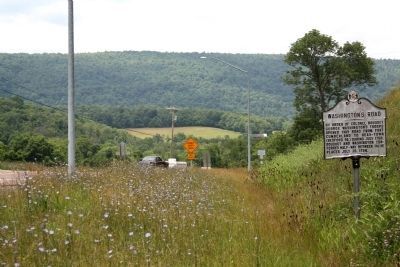
Location. 39° 43.335′ N, 78° 42.328′ W. Marker is near Dickens, Maryland, in Allegany County. Marker is on U.S. 220, on the right when traveling north. Marker just before the Pennsylvania state line. Touch for map. Marker is in this post office area: Cumberland MD 21502, United States of America. Touch for directions.
Other nearby markers. At least 8 other markers are within 4 miles of this marker, measured as the crow flies. Pennsylvania (approx. 0.3 miles away in Pennsylvania); Camp Mason & Dixon (approx. 0.7 miles away in Pennsylvania); Union Grove School (approx. 1.2 miles away); Evart's Homesite (approx. 2.3 miles away); American Indian Rockshelter Trail (approx. 2.7 miles away); The Naming of the Lake (approx. 2.8 miles away); Life in Pleasant Valley (approx. 3.3 miles away); Martins Mountain (approx. 3½ miles away).

William J. Pratt - Maryland Historical Trust (Historic Sites Survey), January 17, 1978
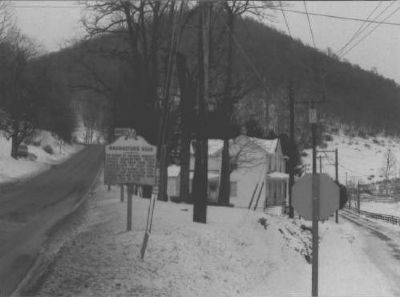
3. Washington's Road Marker
View is from the south, looking north. This marker has surely been moved since this photograph was taken, due to the widening of the road. The road that goes off to the right was Pine Ridge Road. The road on which it was first erected appears to have been renamed Granet Road, which now dead-ends before reaching US 220.
Credits. This page was last revised on February 16, 2021. It was originally submitted on March 10, 2008, by Christopher Busta-Peck of Shaker Heights, Ohio. This page has been viewed 1,927 times since then and 37 times this year. Last updated on February 14, 2021, by Carl Gordon Moore Jr. of North East, Maryland. Photos: 1, 2. submitted on August 28, 2011, by J. J. Prats of Powell, Ohio. 3. submitted on March 10, 2008, by Christopher Busta-Peck of Shaker Heights, Ohio. • Bill Pfingsten was the editor who published this page.

