Moultrie in Colquitt County, Georgia — The American South (South Atlantic)
Totem Pole
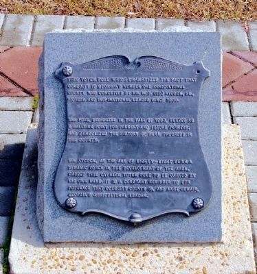
The pole, dedicated in the Fall in 1963, serves as a rallying point for present and future farmers; and symbolizes the history of farm progress in the county.
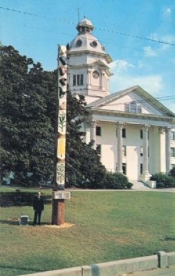
Mr. Aycock, at the age of eighty-eight being a dynamic force in the development of the area, caused this cypress totem pole to be carved by his own hand. It is a constant reminder to our populace that Colquitt County is, and must remain, Georgia’s agricultural leader.
Topics. This historical marker is listed in this topic list: Agriculture. A significant historical year for this entry is 1909.
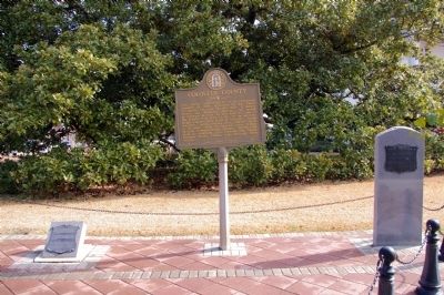
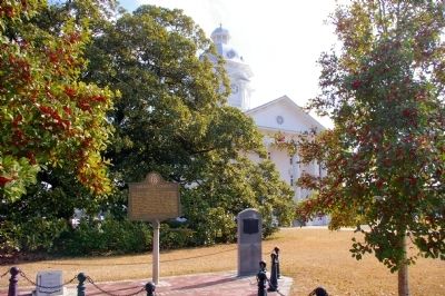
Location. 31° 10.767′ N, 83° 47.317′ W. Marker is in Moultrie, Georgia, in Colquitt County. Marker is at the intersection of North Main Street (Georgia Route 33) and East Central Avenue, on the right when traveling north on North Main Street. The marker is located on the lawn of the Colquitt County Courthouse. Touch for map. Marker is in this post office area: Moultrie GA 31768, United States of America. Touch for directions.
Other nearby markers. At least 8 other markers are within walking distance of this marker. Magnolia Tree (a few steps from this marker); Colquitt County (a few steps from this marker); Colquitt County Courthouse (within shouting distance of this marker); Colquitt County Confederate Monument (within shouting distance of this marker); Friedlander's Department Store (about 400 feet away, measured in a direct line); Carnegie Library of Moultrie (about 500 feet away); Colonial Dames of America Centennial Sundial (about 600 feet away); Old Colquitt County Jail (about 600 feet away). Touch for a list and map of all markers in Moultrie.
Regarding Totem Pole. Eventually the portion of the totem pole that was underground began to rot, and in the early 1980s it was removed from the courthouse lawn. Its present location, or even if it exists at all, is unknown.
Credits. This page was last revised on June 16, 2016. It was originally submitted on November 15, 2012, by David Seibert of Sandy Springs, Georgia. This page has been viewed 1,159 times since then and 40 times this year. Photos: 1, 2, 3, 4, 5. submitted on November 15, 2012, by David Seibert of Sandy Springs, Georgia. • Bill Pfingsten was the editor who published this page.


