Marker Logo HMdb.org THE HISTORICAL
MARKER DATABASE
“Bite-Size Bits of Local, National, and Global History”
Hancock in Washington County, Maryland — The American Northeast (Mid-Atlantic)
 

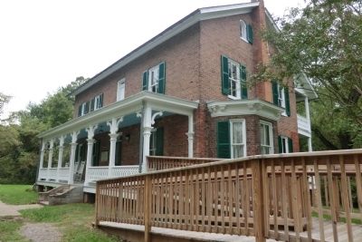
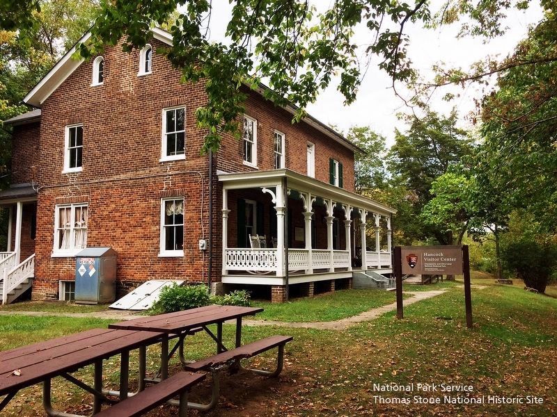
The Historic Bowles House

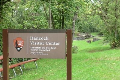
Hancock Visitor Center

— Chesapeake and Ohio Canal National Historical Park —


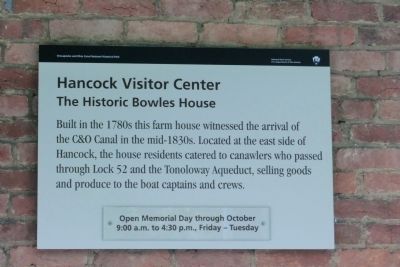
Chesapeake and Ohio Canal National Historical Park Marker image. Click for full size.
Photographed By Don Morfe, September 30, 2011
1. Chesapeake and Ohio Canal National Historical Park Marker
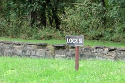
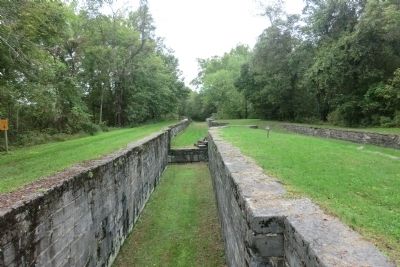
Inscription. Built in the 1780’s this farm house witnessed the arrival of the C&O Canal in the mid-1830’s. Located at the east side of Hancock, the house residents catered to canawlers who passed through Lock 52 and the Tonoloway Aqueduct, selling goods and produce to the boat captains and crews.
 
Erected by National Park Service, U.S. Department of the Interior.
 
Topics and series. This historical marker is listed in these topic lists: Industry & CommerceWaterways & Vessels. In addition, it is included in the Chesapeake and Ohio (C&O) Canal series list.
 
Location. 39° 41.636′ N, 78° 9.29′ W. Marker is in Hancock, Maryland, in Washington County. Marker can be reached from the intersection of East Main Street (Maryland Route 144) and Ford Drive, on the right when traveling east. Touch for map. Marker is at or near this postal address: 326 East Main Street, Hancock MD 21750, United States of America. Touch for directions.
 
Other nearby markers. At least 8 other markers are within 2 miles of this marker, measured as the crow flies. A Work of Art (about 500 feet away, measured in a direct line); Comm. Bruce Clipp (approx. half a mile away); Railroad Siding & Coal Trestle (approx. one mile away); Hancock Presbyterian Church (approx. 1.2 miles away); a different marker also
Paid Advertisement
Click on the ad for more information.
Please report objectionable advertising to the Editor.
Click or scan to see
this page online
named Hancock Presbyterian Church (approx. 1.2 miles away); These Bricks (approx. 1.2 miles away); In Honor and Remembrance (approx. 1.2 miles away); St. Thomas Episcopal Church (approx. 1.3 miles away). Touch for a list and map of all markers in Hancock.
 
Also see . . .
1. Chesapeake & Ohio Canal National Historical Park. National Park Service (Submitted on July 25, 2016.) 

2. Stuccoed Farmhouse (Bowles House), Maryland Inventory of Historic Properties. (Submitted on September 23, 2019.)
 
Chesapeake and Ohio Canal National Historical Park Marker image. Click for full size.
Photographed By Don Morfe, September 30, 2011
2. Chesapeake and Ohio Canal National Historical Park Marker
Chesapeake and Ohio Canal National Historical Park Marker image. Click for full size.
Photographed By Don Morfe, September 30, 2011
3. Chesapeake and Ohio Canal National Historical Park Marker
Chesapeake and Ohio Canal National Historical Park Marker image. Click for full size.
Photographed By Don Morfe, September 30, 2011
4. Chesapeake and Ohio Canal National Historical Park Marker
Chesapeake and Ohio Canal National Historical Park Marker image. Click for full size.
Photographed By Don Morfe, September 30, 2011
5. Chesapeake and Ohio Canal National Historical Park Marker
Chesapeake and Ohio Canal National Historical Park Marker image. Click for full size.
Photographed By Don Morfe, September 30, 2011
6. Chesapeake and Ohio Canal National Historical Park Marker
Chesapeake and Ohio Canal National Historical Park Marker image. Click for full size.
Photographed By Don Morfe, September 30, 2011
7. Chesapeake and Ohio Canal National Historical Park Marker
Chesapeake and Ohio Canal National Historical Park Marker image. Click for full size.
Photographed By Don Morfe, September 30, 2011
8. Chesapeake and Ohio Canal National Historical Park Marker
The Historic Bowles House Marker & Hancock Visitor Center Sign image. Click for full size.
National Park Service, Thomas Stone National Historic Site, September 16, 2019
9. The Historic Bowles House Marker & Hancock Visitor Center Sign
Viewing east towards marker, which is barely visible on the structure's porch.
 
 
Credits. This page was last revised on October 7, 2019. It was originally submitted on November 17, 2012, by Don Morfe of Baltimore, Maryland. This page has been viewed 744 times since then and 11 times this year. Photos:   1, 2, 3, 4, 5, 6, 7, 8. submitted on November 17, 2012, by Don Morfe of Baltimore, Maryland.   9. submitted on September 23, 2019. • Bill Pfingsten was the editor who published this page.
Share this page.  
Share on Tumblr
m=61164

CeraNet Cloud Computing sponsors the Historical Marker Database.
This website earns income from purchases you make after using our links to Amazon.com. We appreciate your support.
Paid Advertisement
Apr. 23, 2024