Fort Oglethorpe in Catoosa County, Georgia — The American South (South Atlantic)
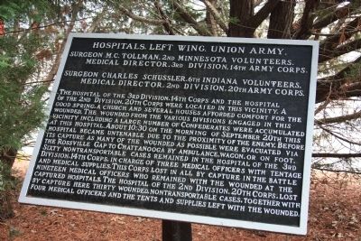
Hospitals, Left Wing, Union Army.
Surgeon M.C. Tollman, 2nd Minnesota Volunteers.
— Medical Director, 3rd Division, 14th Army Corps. —
Surgeon M.C. Tollman, 2nd Minnesota Volunteers.
Medical Director, 3rd Division, 14th Army Corps.
Surgeon Charles Schussler, 6th Indiana Volunteers.
Medical Director, 2nd Division, 20th Army Corps.
The hospital of the 3rd Division, 14th Corps and the hospital of the 2nd Division, 20th Corps were located in this vicinity. A good spring, a church and several houses afforded comfort for the wounded. The wounded from the various divisions engaged in this vicinity including a large number of Confederates were accumulated at this hospital. About 10:30 on the morning of September 20th this hospital became untenable due to the proximity of the enemy. Before its capture as many of the wounded as possible were evacuated via the Rossville Gap to Chattanooga by ambulance, wagon, or on foot. Sixty nontransportable cases remained in the hospital of the 3rd Division, 14th Corps, in charge of three medical officers with tentage and medical supplies. This Corps lost in all by capture in the battle nineteen medical officers who remained with the wounded at the captured hospitals. The hospital of the 2nd Division, 20th Corps, lost by capture here thirty wounded, nontransportable cases, together with four medical officers and the tents and supplies left with the wounded.
Erected 1890 by the Chickamauga and Chattanooga National Military Park Commission. (Marker Number MT-476.)
Topics. This historical marker is listed in this topic list: War, US Civil. A significant historical date for this entry is September 20, 1932.
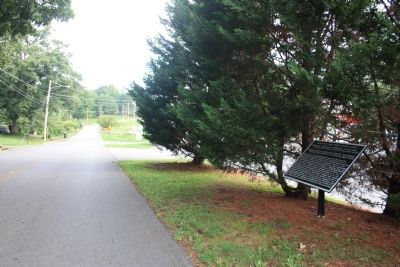
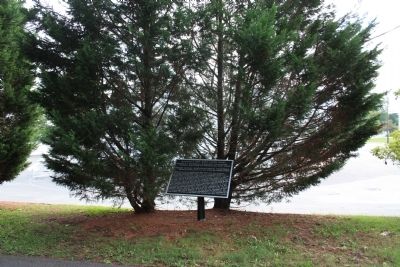
Location. 34° 57.115′ N, 85° 15.585′ W. Marker is in Fort Oglethorpe, Georgia, in Catoosa County. Marker is on Old Lafayette Road north of Gilbert Drive, on the left when traveling south. This historic marker is located in a cluster of pine trees between the roadside and a business parking lot, and where this road runs just west and parallel to the new Lafayette Road for a couple of blocks, and just south of Battlefield Parkway (State Route 2). Touch for map. Marker is in this post office area: Fort Oglethorpe GA 30742, United States of America. Touch for directions.
Other nearby markers. At least 8 other markers are within walking distance of this marker. Armstrong's Brigade. (a few steps from this marker); Armstrong's Division - Forrest's Cavalry Corps. (a few steps from this marker); Tennessee C.S.A. Cavalry (a few steps from this marker); 1st Regiment & 18th Battalion Tennessee Cavalry (within shouting distance of this marker); Shaw's Tennessee Battery (within shouting distance of this marker); 1st Georgia Cavalry (about 300 feet away, measured in a
direct line); Forrest's Pursuit (about 300 feet away); Forrest's (Cavalry) Corps. (about 300 feet away). Touch for a list and map of all markers in Fort Oglethorpe.
Credits. This page was last revised on July 2, 2017. It was originally submitted on November 20, 2012, by Dale K. Benington of Toledo, Ohio. This page has been viewed 587 times since then and 6 times this year. Photos: 1, 2, 3. submitted on November 21, 2012, by Dale K. Benington of Toledo, Ohio.


