Wink in Winkler County, Texas — The American South (West South Central)
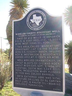
Winkler County Discovery Well
"Hendrick No.1"; Site 1.5 Miles Northeast
This area, called "Wildcatters' graveyard", lay on the 30,000-acre T.G. Hendrick ranch. Drillers Roy A. Westbrook & Associates leased land at 10 cents an acre.
Well arrived dramatically, in great blasts of oil and rock, about midnight, Sept. 3, 1926. Its eventual depth was 3,049 feet. Total production when plugged in 1939 was 235,000 barrels.
Data gathered here was vital in future drilling of El Capitan reef lime, a major oil-bearing geologic formation.
Erected 1972 by State Historical Survey Committee. (Marker Number 5868.)
Topics. This historical marker is listed in these topic lists: Exploration • Industry & Commerce. A significant historical date for this entry is September 3, 1946.
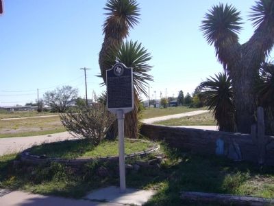
Location. 31° 45.363′ N, 103° 9.392′ W. Marker is in Wink, Texas, in Winkler County. Marker is on Hendricks Boulevard (State Highway 115) 0.4 miles north of SE 1st Street (Farm to Market Road 1232), on the right when traveling north. Touch for map. Marker is in this post office area: Wink TX 79789, United States of America. Touch for directions.
Other nearby markers. At least 8 other markers are within 9 miles of this marker, measured as the crow flies. Wink (about 700 feet away, measured in a direct line); Roy Orbison (approx. ¼ mile away); Old Wink Cemetery (approx. 1.6 miles away); Old Duval Townsite (approx. 5.9 miles away); The Community Church (approx. 7.8 miles away); Colonel C. M. Winkler (approx. 7.9 miles away); Kermit (approx. 8 miles away); Moorhead Cable Tool Rig (approx. 8.3 miles away). Touch for a list and map of all markers in Wink.
Credits. This page was last revised on June 16, 2016. It was originally submitted on November 22, 2012, by Bill Kirchner of Tucson, Arizona. This page has been viewed 590 times since then and 38 times this year. Photos: 1, 2, 3. submitted on November 22, 2012, by Bill Kirchner of Tucson, Arizona. • Bernard Fisher was the editor who published this page.


