Chester in Middlesex County, Connecticut — The American Northeast (New England)
Chester-Hadlyme Ferry
Second Oldest Ferry on the Connecticut River
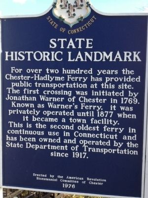
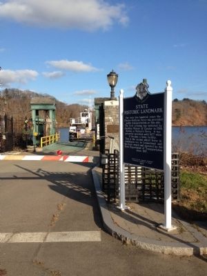
For over two hundred years the Chester-Hadlyme Ferry has provided public transportation at this site. The first crossing was initiated by Johnathan Warner of Chester in 1769. Known as Warner's Ferry, it was privately operated until 1877 when it became a town facility. This is the second oldest ferry in continuous use in Connecticut and has been owned and operated by the State Department of Transportation since 1917.
Erected 1976 by Erected by the American Revolution Bicentennial Committee of Chester.
Topics. This historical marker is listed in these topic lists: Industry & Commerce • Roads & Vehicles • Waterways & Vessels. A significant historical year for this entry is 1769.
Location. 41° 25.137′ N, 72° 26.054′ W. Marker is in Chester, Connecticut, in Middlesex County. Marker is on Ferry Road (U.S. 148), on the right when traveling east. Touch for map. Marker is in this post office area: Chester CT 06412, United States of America. Touch for directions.
Other nearby markers. At least 8 other markers are within 2 miles of this marker, measured as the crow flies. Impressionism in Connecticut (approx. 0.3 miles away); a different marker also named Chester-Hadlyme Ferry (approx. 0.3 miles away); Chester Veterans Monument (approx. 1.3 miles away); Chester World War II – Korea Memorial (approx. 1.3 miles away); Chester World War I Monument (approx. 1.3 miles away); Chester (approx. 1.4 miles away); The Underground Railroad (approx. 1.7 miles away); Piano Works (approx. 2 miles away). Touch for a list and map of all markers in Chester.
Also see . . .
1. Connecticut Department of Transportation Chester-Hadlyme Ferry. (Submitted on June 15, 2013, by Michael Herrick of Southbury, Connecticut.)
2. Chester-Hadlyme Ferry on Wikipedia. (Submitted on June 15, 2013, by Michael Herrick of Southbury, Connecticut.)
Additional keywords. Ferry
Credits. This page was last revised on January 26, 2024. It was originally submitted on November 24, 2012, by Rod Funston of Eastham, Massachusetts. This page has been viewed 522 times since then and 19 times this year. Photos: 1, 2. submitted on November 24, 2012, by Rod Funston of Eastham, Massachusetts. 3, 4. submitted on June 15, 2013, by Michael Herrick of Southbury, Connecticut. • Bill Pfingsten was the editor who published this page.


