Andrews in Andrews County, Texas — The American South (West South Central)
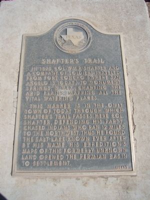
Shafter's Trail
This marker is in the only town of today through which Shafter's Trail passes. Here Col. Shafter, defending his party, chased Indians who ran 12 miles to the northwest. Thus he found the salt lake known ever after by his name. His expedition's maps of this formerly unknown land opened the Permian Basin to settlement.
Erected 1965 by State Historical Survey Committee. (Marker Number 4654.)
Topics. This historical marker is listed in these topic lists: Exploration • Settlements & Settlers. A significant historical year for this entry is 1875.
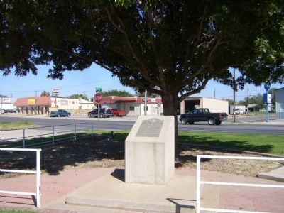
Location. 32° 18.845′ N, 102° 32.723′ W. Marker is in Andrews, Texas, in Andrews County. Marker is at the intersection of Andrews Street and South Main Street (U.S. 385), on the right when traveling north on Andrews Street. Touch for map. Marker is in this post office area: Andrews TX 79714, United States of America. Touch for directions.
Other nearby markers. At least 8 other markers are within walking distance of this marker. Billionth Barrel (approx. 0.4 miles away); Two Billionth Barrel (approx. 0.4 miles away); C.E. Carruth Bi-Centennial Building (approx. 0.6 miles away); Vietnam War (approx. 0.6 miles away); Andrews County Veterans Memorial (approx. 0.6 miles away); Means Methodist Church (approx. 0.6 miles away); World War II (approx. 0.6 miles away); American Civil War / Spanish American War (approx. 0.6 miles away). Touch for a list and map of all markers in Andrews.
Credits. This page was last revised on June 16, 2016. It was originally submitted on November 25, 2012, by Bill Kirchner of Tucson, Arizona. This page has been viewed 1,015 times since then and 22 times this year. Photos: 1, 2. submitted on November 25, 2012, by Bill Kirchner of Tucson, Arizona. • Bernard Fisher was the editor who published this page.

