Near Andrews in Andrews County, Texas — The American South (West South Central)
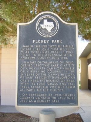
Florey Park
In heart of the Means Oil Field, opened 1930, this park is at site of a 1934-1958 camp of Humble Oil and Refining Company. In the 24 years of the camp's history, its many residents developed an oasis here. The recreation area, with its lush grass and tall trees, attracted visitors from all parts of the county.
On September 22, 1958, Humble Company donated the land to be used as a county park.
Erected 1965 by State Historical Survey Committee. (Marker Number 1923.)
Topics. This historical marker is listed in these topic lists: Industry & Commerce • Settlements & Settlers. A significant historical year for this entry is 1909.
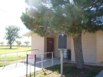
Location. 32° 27.267′ N, 102° 34.245′ W. Marker is near Andrews, Texas, in Andrews County. Marker can be reached from County Park Road, 1.3 miles east of U.S. 385, on the right when traveling east. Marker is in Old Florey Park, by the rest rooms. Touch for map. Marker is in this post office area: Andrews TX 79714, United States of America. Touch for directions.
Other nearby markers. At least 8 other markers are within 10 miles of this marker, measured as the crow flies. Shafter Lake Townsite (approx. 7.6 miles away); Means Methodist Church (approx. 9.3 miles away); Two Billionth Barrel (approx. 9.4 miles away); Billionth Barrel (approx. 9.4 miles away); Fight Against Terrorism (approx. 9˝ miles away); Korean War (approx. 9˝ miles away); World War II (approx. 9˝ miles away); World War I (approx. 9˝ miles away). Touch for a list and map of all markers in Andrews.
Credits. This page was last revised on June 16, 2016. It was originally submitted on November 26, 2012, by Bill Kirchner of Tucson, Arizona. This page has been viewed 1,190 times since then and 42 times this year. Photos: 1, 2. submitted on November 26, 2012, by Bill Kirchner of Tucson, Arizona. • Bernard Fisher was the editor who published this page.

