Near Durham in Butte County, California — The American West (Pacific Coastal)
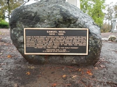
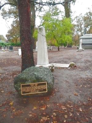
Samuel Neal
1816 – 1859
“We today all owe a debt to this early pioneer”
Erected 1996 by E Clampus Vitus, Pair-O-Dice Chapter No. 7-11.
Topics and series. This historical marker is listed in these topic lists: Exploration • Industry & Commerce • Settlements & Settlers. In addition, it is included in the E Clampus Vitus series list. A significant historical year for this entry is 1844.
Location. 39° 40.532′ N, 121° 46.197′ W. Marker is near Durham, California, in Butte County. Marker can be reached from Oroville-Chico Hwy. Touch for map. Marker is at or near this postal address: 1727 Oroville-Chico Hwy, Durham CA 95938, United States of America. Touch for directions.
Other nearby markers. At least 8 other markers are within 6 miles of this marker, measured as the crow flies. W.W. Durham House (approx. 2.4 miles away); Chico Forestry Station and Nursery (approx. 5.3 miles away); Chico World War I Memorial (approx. 5.4 miles away); General John and Annie K. Bidwell Gravesite (approx. 5˝ miles away); Chico Cemetery G.A.R. Monument (approx. 5˝ miles away); The Life and Times of John Bidwell (approx. 5.6 miles away); The Historic Home of Annie and John Bidwell (approx. 5.6 miles away); Rancho Del Arroyo Chico (approx. 5.6 miles away).
Also see . . . Rancho Esquon - Wikipedia. Rancho Esquon (also called Neal’s Rancho) was a 22,194-acre (89.82 km2) Mexican land grant in present day Butte County, California given in 1844 by Governor Manuel Micheltorena to Samuel Neal. (Submitted on December 14, 2012, by Barry Swackhamer of Brentwood, California.)
Credits. This page was last revised on November 3, 2019. It was originally submitted on December 14, 2012, by Barry Swackhamer of Brentwood, California. This page has been viewed 855 times since then and 38 times this year. Photos: 1, 2, 3, 4. submitted on December 14, 2012, by Barry Swackhamer of Brentwood, California. • Syd Whittle was the editor who published this page.


