Near Providence Forge in Charles City County, Virginia — The American South (Mid-Atlantic)
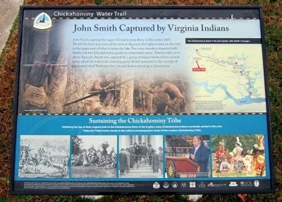
John Smith Captured by Virginia Indians
Chickahominy Water Trail
Sustaining the Chickahominy Tribe
Following the loss of their original land on the Chickahominy River to the English, many Chickahominy Indians eventually settled in this area. Today the Tribal Center stands as the cultural and geographic center of the modern Chickahominy Tribe.
Chickahominy Water Trail and Captain John Smith’s Voyages
Learn more about the Capt. John Smith Chesapeake National Historic Trail and Chickahominy culture by visiting exhibits at River’s Rest Marina, Chickahominy Riverfront Park and Rockahock Campground.
This interpretive sign was created by the James River Association with the assistance of Charles City County, New Kent County, James City County, the Chickahominy Tribe, the Virginia Foundation for the Humanities, the Virginia Council on Indians, and the Virginia Department of Conservation and Recreation. For more information contact the James River Association at (804) 788-8811 or visit www.jamesriverassociation.org. Find more information on following Captain Smith’s explorations of Virginia at www.johnsmithtrail.org and tracing his voyages around the Chesapeake Bay at www.smithtrail.net.
Erected by James River Association.
Topics. This historical marker is listed in these topic lists: Colonial Era • Exploration • Native Americans. A significant historical month for this entry is December 1607.
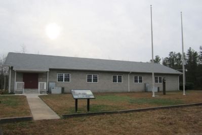
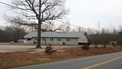
Location. 37° 24.732′ N, 77° 7.524′ W. Marker is near Providence Forge, Virginia, in Charles City County. Marker can be reached from the intersection of Lot Cary Road (Virginia Route 602) and Samaria Lane, on the left when traveling south. Located at the Chickahominy Tribal Center. Touch for map. Marker is at or near this postal address: 8200 Lot Cary Rd, Providence Forge VA 23140, United States of America. Touch for directions.
Other nearby markers. At least 8 other markers are within 5 miles of this marker, measured as the crow flies. Action of Nance's Shop (approx. 1.9 miles away); Old Quaker Settlement - Adkins Store (approx. 2 miles away); Stuart's Ride (approx. 2˝ miles away); Roxbury (approx. 2.6 miles away); Barnetts (approx. 3.7 miles away); Lott Cary Birthplace (approx. 4.4 miles away); Long Bridge (approx. 4˝ miles away); Letitia Christian Tyler (approx. 4.8 miles away).
More about this marker. (captions)
The Chickahominy Tribe and the English enter into a treaty in 1614. Image courtesy of the Virginia Historical Society
An early inter-tribal gathering during a cultural revival amongst Virginia Indians in the early 1900s. Image courtesy of the Library of Virginia
Tribal members participate in a ceremonial tribute to the State of Virginia in 1919. Image courtesy of the National Anthropological Archives, Smithsonian Institution.
Chief Stephen Adkins advocates for Virginia Indians and the Chickahominy Tribe. Image courtesy of the National Museum of the American Indian, Smithsonian Institution.
Dancers at the annual Chickahominy Pow-Wow celebrate heritage and share traditions. Image courtesy of Robert Llewellyn.
Also see . . .
1. James River Association. (Submitted on December 16, 2012.)
2. Captain John Smith's Trail. (Submitted on December 16, 2012.)
3. Captain John Smith Chesapeake National Historic Trail. (Submitted on December 16, 2012.)
Credits. This page was last revised on June 16, 2016. It was originally submitted on December 16, 2012, by Bernard Fisher of Richmond, Virginia. This page has been viewed 1,054 times since then and 43 times this year. Photos: 1, 2, 3. submitted on December 16, 2012, by Bernard Fisher of Richmond, Virginia.


