Victor in Ontario County, New York — The American Northeast (Mid-Atlantic)
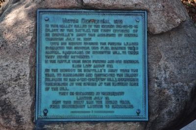
Victor Centennial, 1913
With his second division the French leader overawed the Senecas, who fled, burning their capital Gannagaro, on Boughton Hill, to which they never returned.
In the battle were 2300 French and Senecas, each lost about 100.
On the morrow De Nonville's army took the trail to Gannagaro and destroyed the nearby palisade on Gah-a-yan-duk (Fort Hill), refreshing themselves at the spring of the eastern base of the hill. They re-embarked at Irondequoit Landing July 19. Past this point, ran the Indian trail from Irondequoit Landing to Gannagaro.
Erected 1913.
Topics. This historical marker is listed in these topic lists: Colonial Era • Native Americans • Settlements & Settlers. A significant historical date for this entry is July 13, 1779.
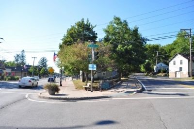
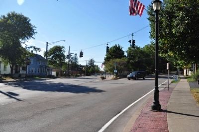
Location. 42° 59.078′ N, 77° 24.837′ W. Marker is in Victor, New York, in Ontario County. Marker is at the intersection of West Main Street (New York State Route 96) and High Street on West Main Street. Touch for map. Marker is in this post office area: Victor NY 14564, United States of America. Touch for directions.
Other nearby markers. At least 8 other markers are within 2 miles of this marker, measured as the crow flies. Mead Square (approx. 0.2 miles away); Athasata (Kryn) (approx. ¼ mile away); Site of Home and Laboratory of Fred M. Locke (approx. 0.8 miles away); Rochester Area (approx. one mile away); Dyagodiyu (approx. 1.3 miles away); Graves (approx. 1.3 miles away); Gano'so:d (approx. 1.4 miles away); Gannagaro (approx. 1.4 miles away). Touch for a list and map of all markers in Victor.
More about this marker. Events on this marker correlate to the Athasata marker a couple hundred yards to the east at the corner of 96 and 444.
Credits. This page was last revised on June 16, 2016. It was originally submitted on December 16, 2012, by Yugoboy of Rochester, New York. This page has been viewed 530 times since then and 38 times this year. Photos: 1, 2, 3. submitted on December 16, 2012, by Yugoboy of Rochester, New York. • Bill Pfingsten was the editor who published this page.


