Near Baldwyn in Lee County, Mississippi — The American South (East South Central)
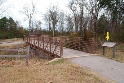
Tishomingo Creek Bridge
Inscription.
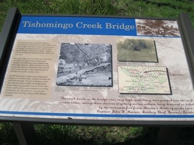
The Federal retreat at the Battle of Brice's Crossroads was funneled onto a small bridge across Tishomingo Creek. The structure was too narrow for Sturgis' Expeditionary Force, and the span quickly became a bottleneck as horses, wagons, cannon, and men all raced to cross the creek at the same time.
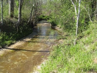
The rains of the previous several days had raised the water level of the deeply banked creek, making it very difficult to cross without using the bridge. Panicked soldiers and horses in full retreat attempted to swim across; many crossed successfully, but others were swept away by the rushing waters of the swollen creek.
In 1953 some local residents discovered human remains in the Tishomingo creekbed, less than 100 yards from this spot. The partial skeleton is most likely that of a Union soldier who fought at the Battle of Brice's Crossroads, and was found with a pocket watch and the rusted remnants of an Army canteen and rifle. The bones are now interred alongside other Civil War soldiers in the Bethany Cemetery.
Bottom Quote: "The creek banks at the bridge were very high, and many men jumped into the swift stream below, taking their chances at getting across without being drowned or killed by the incessant fire from Morton's Artillery on the bank." Captain John W. Morton, Artillery Chief, Forrest's Cavalry
Upper Right Corner Drawing: "Deadbrook after the Battle of Ezra's Church" Harper's Weekly
Center Photograph: Grapevine Bridge over the Chickahominy River in Virginia, built by the 5th New Hampshire Infantry, May 1862. Photographed by D. B. Woodbury. Library of Congress, Prints and Photographs Division, Civil War Photographs
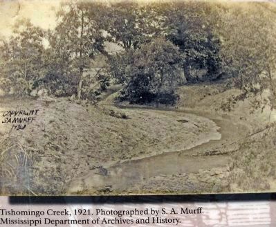
Top Right Photograph: Tishomingo Creek, 1921. Photographed by S. A. Murff. Mississippi Department of Archives and History
Bottom Right Map: Bridge Location. The Official Military Atlas of the Civil War. David Rumsey Map Collection
Topics. This historical marker is listed in this topic list: War, US Civil. A significant historical year for this entry is 1953.
Location. 34° 30.7′ N, 88° 44.007′ W. Marker is near Baldwyn, Mississippi, in Lee County. Marker can be reached from Ripley Road (County Route 370) half a mile west of Bethany Road (County Route 370), on the right when traveling west. The marker is in a small park with parking lot at the Tishomingo Creek Bridge. It is designated as part of Stop 7 of the Brice's Crossroads Auto Tour. Touch for map. Marker is in this post office area: Baldwyn MS 38824, United States of America. Touch for directions.
Other nearby markers. At least 8 other markers are within walking distance of this marker. Chief Tishomingo (a few steps from this marker); Spoils of War (a few steps from this marker); a different marker also named Tishomingo Creek Bridge
(about 300 feet away, measured in a direct line); General Barteau's Flank Movement (about 300 feet away); Terrain and Landscape (about 500 feet away); Union Wagon Train (about 500 feet away); Artillery at Log Cabin Ridge (about 500 feet away); Brice's Cross Roads (about 600 feet away). Touch for a list and map of all markers in Baldwyn.
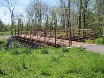
More about this marker. The park contains a replica civil war-era bridge at the same location as the original Tishomingo Creek bridge.
Also see . . . Wikipedia entry for the Battle of Brices Crossroads. (Submitted on December 17, 2012, by David Graff of Halifax, Nova Scotia.)
Credits. This page was last revised on June 16, 2016. It was originally submitted on December 17, 2012, by David Graff of Halifax, Nova Scotia. This page has been viewed 898 times since then and 50 times this year. Photos: 1, 2, 3, 4. submitted on December 17, 2012, by David Graff of Halifax, Nova Scotia. 5. submitted on December 3, 2015, by Brandon Fletcher of Chattanooga, Tennessee. • Craig Swain was the editor who published this page.
