Near Baldwyn in Lee County, Mississippi — The American South (East South Central)
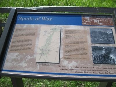
Spoils of War
Just one month after the Battle of Brice's Crossroads, Union and Confederate troops faced off again at the Battle of Tupelo. Union general A. J. Smith and his troops defeated the Confederates on July 14, but seeing that his supplies were running low, Smith opted to return to Memphis. While it was a retreat in the technical sense of the word, it in no way resembled the panicked flight of General Sturgis' force just a few weeks earlier.
General Forrest, on examining the tables turned in by his provost marshall, chief quartermaster, and chief of ordnance, learned that his command had captured the following at Brice's Crossroads:
- Personnel: Col. G W McKeaig of the 10th Illinois; 1 assistant surgeon; 18 captains; 40 lieutenants; 87 noncommissioned officers; 3 musicians; and 1,468 privates; or a total of 1,618 men.
- Quartermaster Property: 161 mules; 23 horses; 168 six-horse wagons; 7 four-horse wagons; 1 two-horse wagon; 16 ambulances; and hundreds of sets of harnesses.
- Ordnance stores: 16 cannon (one 3-inch ordnance rifle, five James rifles, five 6-pounder guns, two 12-pounder Napoleons); 28 limbers; 15 caissons; hundreds of rounds of artillery ammunition (shot, canister, and spherical case); 15,000 stands of small-arms; 300,000 rounds of small-arms ammunition; several hundred accoutrements (cap-pouches and cartridge-boxes); and a number of sets of artillery harness.
Forrest at Brice's Crossroads and in North Mississippi in 1864, p. 133 (Morningside Books) by Edwin C. Bearss
Bottom Quote: "The lines were broken at and near the cross-roads, and when the defeated infantry reached the bridge it was only as a mob ..." Captain William Forse Scott, 4th Iowa Cavalry
Top Right Corner Drawing: "Retreat of the Confederate Garrison," Frank Leslie's Illustrated Newspaper
Center Map: "Map of the Roads and Adjacent Country Between Stubbs' Plantation and Brice's Cross-Roads, Miss.," The Official Military Atlas of the Civil War, David Rumsey Map Collection
Top Right Drawing: "Blenker's Brigade Covering the Retreat near Centerville," Harper's Weekly
Bottom Right Drawing: "Retreat of Federal Troops from the Virginia Shore," Frank Leslie's Illustrated Newspaper
Topics. This historical marker is listed in this topic list: War, US Civil. A significant historical month for this entry is July 1746.
Location.
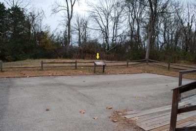
34° 30.701′ N, 88° 44.021′ W. Marker is near Baldwyn, Mississippi, in Lee County. Marker can be reached from Ripley Road (County Route 370) half a mile west of Bethany Road (County Route 370), on the right when traveling west. Marker is in a small park with parking lot at the Tishomingo Creek Bridge. It is at a handicap ramp at the west end of the replica bridge. This is designated as part of Stop 7 of the Brices Crossroads Auto Tour and is a half mile northwest of the NPS acre at Brice's Crossroads. Touch for map. Marker is in this post office area: Baldwyn MS 38824, United States of America. Touch for directions.
Other nearby markers. At least 8 other markers are within walking distance of this marker. Tishomingo Creek Bridge (a few steps from this marker); Chief Tishomingo (within shouting distance of this marker); a different marker also named Tishomingo Creek Bridge (about 300 feet away, measured in a direct line); General Barteau's Flank Movement (about 300 feet away); Terrain and Landscape (about 500 feet away); Union Wagon Train (about 500 feet away); Artillery at Log Cabin Ridge (about 600 feet away); Brice's Cross Roads (about 700 feet away). Touch for a list and map of all markers in Baldwyn.
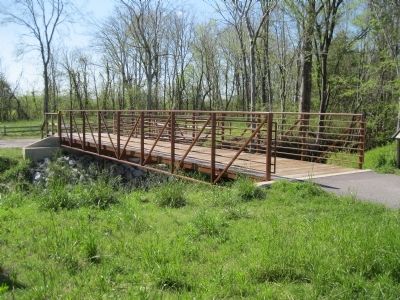
More about this marker. There is a replica civil war-era bridge here at the original location of the Tishomingo Creek bridge.
Also see . . . Wikipedia Entry for the Battle of Brice's Crossroads. (Submitted on December 17, 2012, by David Graff of Halifax, Nova Scotia.)
Credits. This page was last revised on June 16, 2016. It was originally submitted on December 17, 2012, by David Graff of Halifax, Nova Scotia. This page has been viewed 824 times since then and 65 times this year. Photos: 1, 2. submitted on December 17, 2012, by David Graff of Halifax, Nova Scotia. 3. submitted on December 3, 2015, by Brandon Fletcher of Chattanooga, Tennessee. • Craig Swain was the editor who published this page.


