Near Manassas in Prince William County, Virginia — The American South (Mid-Atlantic)
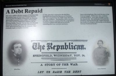
A Debt Repaid
In 1886, John Rice returned to the Bull Run battlefield and found the Bensons at Christian Hill. Rice inquired how he might repay them for their past kindness. The Bensons, active members of Sudley Church, remarked that the congregation remained saddled with debt incurred from rebuilding their war-wrecked sanctuary.
Upon returning home, Rice took his story to the local newspaper. Within four days, residents contributed $235 – more than enough to cover the church debt. Rice jubilantly forwarded the donation, hoping the gift “might dispel the last doubt of a complete and lasting reconciliation between North and South.”
Erected 2012 by Manassas National Battlefield Park, National Park Service, U.S. Department of the Interior.
Topics. This historical marker is listed in these topic lists: Churches & Religion • War, US Civil. A significant historical year for this entry is 1886.
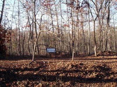
Location. 38° 50.399′ N, 77° 32.187′ W. Marker is near Manassas, Virginia, in Prince William County. Marker can be reached from Sudley Road (Virginia Route 234). Marker is located along the Sudley Loop Trail at Manassas National Battlefield Park. Closest parking is at MNBP Driving Tour Stop No. 5. Touch for map. Marker is at or near this postal address: 5405 Sudley Rd, Manassas VA 20109, United States of America. Touch for directions.
Other nearby markers. At least 8 other markers are within walking distance of this marker. Sudley Methodist Church (about 400 feet away, measured in a direct line); Battling for the Rocky Knoll (about 500 feet away); Sudley Church (about 500 feet away); Sudley (about 600 feet away); Sudley Springs (about 600 feet away); “The Unfinished Railroad” (about 600 feet away); Field Hospital (about 700 feet away); Thornberry House (about 700 feet away). Touch for a list and map of all markers in Manassas.
More about this marker. The marker displays two portraits: on the left side John Rice, on the right side Amos Benson. The background of the marker is a reproduction of the newspaper story headlines mentioned in the marker text.
Also see . . .
1. Manassas National Battlefield Park. (Submitted on December 9, 2012.)
2. The Bensons of Sudley Church. Bull Runnings blog, Harry Smeltzer (Submitted on December 9, 2012.)
Credits. This page was last revised on April 9, 2022. It was originally submitted on December 9, 2012. This page has been viewed 939 times since then and 27 times this year. Last updated on December 22, 2012. Photos: 1, 2, 3. submitted on December 9, 2012. • Craig Swain was the editor who published this page.


