Upper Falls in Rochester in Monroe County, New York — The American Northeast (Mid-Atlantic)
Genesee River Gorge: Industrial & Urban Development
The Bausch Memorial Bridge and Surrounding Area
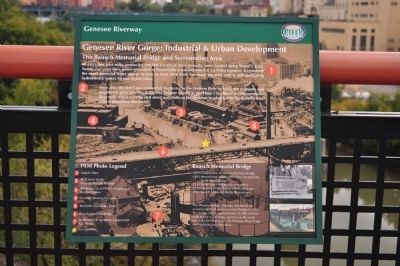
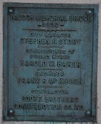
Inscription.
By 1855, ten grist mills, producing 500,000 barrels of flour annually, were located along Brown's Race. Twenty-five years later, power generated at Brown's Raceway estimated at 3,670 horsepower. It remained the most powerful water power system in New York State for many decades and is still generating hydroelectric power for our region today.
Soon after the Erie Canal connected Rochester to the Hudson River in 1825, the economy and population grew quickly. Rochester became known as the Flour City based on the numerous flour mills which were located along the waterfalls on the Genesee in what is now the Brown's Race area of downtown Rochester.
Bausch Memorial Bridge
1873 Construction of the Vincent Place Bridge
1892 Second truss added and bridge renamed the Smith Street Bridge
1930 Smith Street Bridge dismantled
1931 Opening of the Bausch Memorial Bridge
2009 Bausch Memorial Bridge Renovation
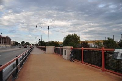
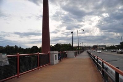
The Phoenix Bridge Company designed and constructed the Bausch Memorial Bridge in 1931. The bridge carries approximately 26,000 vehicles daily in four travel lanes, and two cantilevered sidewalks 913 feet across the Genesee River Gorge and 100 feet above the river.
Topics. This historical marker is listed in these topic lists: Bridges & Viaducts •
Location. 43° 9.949′ N, 77° 37.196′ W. Marker is in Rochester, New York, in Monroe County. It is in Upper Falls. Marker is on Smith Street, ¼ mile east of Lake Ave, on the right when traveling east. Touch for map. Marker is in this post office area: Rochester NY 14608, United States of America. Touch for directions.
Other nearby markers. At least 8 other markers are within walking distance of this marker. Genesee River Gorge: Geology (a few steps from this marker); Genesee River Gorge: 20,000 Years in the Making (approx. 0.3 miles away); Genesee River Gorge: Centuries of Conflict in Pleasant Valley (approx. 0.3 miles away); The Genesee Brew House Building (approx. 0.3 miles away); On this site stood the Standard Brewing Company's main Brewery Building. (approx. 0.3 miles away); Pont de Rennes Pedestrian Bridge (approx. 0.3 miles away); Welcome to the High Falls (approx. 0.4 miles away); Morning of February 18, 1861 (approx. half a mile away). Touch for a list and map of all markers in Rochester.
Photographed By Yugoboy, September 25, 2012
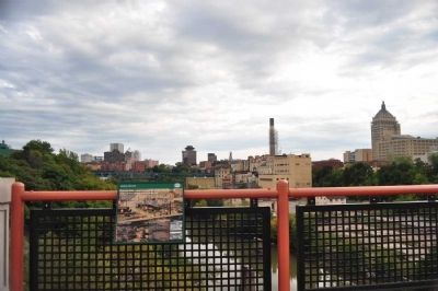
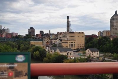
5. Genesee River Gorge: Extant Industrial Buildings
These buildings are some of Rochester Gas & Electric's power generator buildings. Just this week (mid-december 2012), a subterranean tunnel was re-opened below High Falls and this facility is generating hydropower once again.
Credits. This page was last revised on February 16, 2023. It was originally submitted on December 23, 2012, by Yugoboy of Rochester, New York. This page has been viewed 517 times since then and 19 times this year. Photos: 1, 2, 3, 4, 5, 6. submitted on December 23, 2012, by Yugoboy of Rochester, New York. • Bill Pfingsten was the editor who published this page.
