Southport in Brunswick County, North Carolina — The American South (South Atlantic)
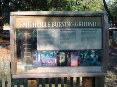
Smithville Burying Ground
“Nor even this hour shall want its charm / For side-by-side still fondly we’ll keep / And calmly in each others arms / Together linked go down the deep.” —From the marker for Emeline L. Taylor and Major George Taylor who were swept from the deck of the steamer San Francisco, on Christmas Eve, December 24, 1853.
This cemetery has served this community (first as Smithville and later as Southport) since the 18th century It is believed that burials took place here beginning with the presence of Fort Johnston in 1745. When the town was officially laid out in 1792 these grounds were marked as burying grounds on the map drawn up by the first commissioners.
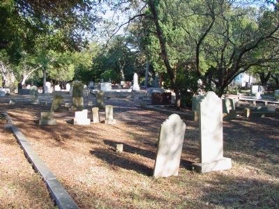
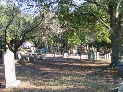
The oldest markers that survived into the 21st century are from 1804. Stories of everyday citizens are told in these markers—love, disease, tragedy, wars, accidents, and time all are represented under the spreading limbs of the sheltering live oaks. These grounds are home to a variety of markers -- monuments and obelisks, tabletop and upright stones as well as vault-like structures. Some have lost their struggle against wind, sand and moss and are no longer legible; others have been taken by the ravages of time but most still give their information in carved stone. Family plots are often marked with enclosures; some continue to he vigilantly maintained and others long abandoned.
Pilots Remembered. Of particular interest is the cenotaph erected by the grieving community following two tragic shipwrecks. The Pilot’s Marker notes that ten men were lost from storms in 1872 and 1877 and states “The winds and the sea sing their Requiem and shall forevermore.” These losses represented a major impact on the families of this small fishing village. Photos from that time show the pilots’ widows, dressed in black, gathered for the dedication of the memorial.
Following a professional archaeological survey in the late 1990's, the city aldermen decreed that the cemetery was beyond capacity and a moratorium on burials was enacted.
Explore the Grounds. As you explore the cemetery see if you can identify graves for some of the following: children marked with lambs; “Little Buddy;” the oldest graves of Captain David Hicks and Captain Andren Currick; graves for veterans; a 21st century Confederate veteran marker; Woodmen of the World memorials; Tony Caseleta, a “ghost who haunts Southport’s Brunswick Inn;” Miss Kate Stuart, Southport’s “best known hostess” at Stuart House; the side by side markers of the wives (both named Sarah) of Dr. Walter Curtis; the Thompson family plot with the grave of the legendary blockade runner, Captain Thomas Mann Thompson.
Topics. This historical marker is listed in this topic list: Cemeteries & Burial Sites. A significant historical month for this entry is December 1961.
Location. 33° 55.233′ N, 78° 0.933′ W. Marker is in Southport, North Carolina, in Brunswick County. Marker is on Rhett Street north of Monroe Street, on the right when traveling north. Touch for map. Marker is in this post office area: Southport NC 28461, United States of America. Touch for directions.
Other nearby markers. At least 8 other markers are within walking distance of this marker. Railroad & Religion on Rhett Street (within shouting distance of this marker); Old Jail (within shouting distance of this marker); Southport’s First Fire Alarm (approx. 0.2 miles away); Franklin Square (approx. 0.2 miles away); Memorial to North Carolina Militia (approx. 0.2 miles away); Fort Johnston (approx. 0.2 miles away); a different marker also named Fort Johnston (approx. ¼ mile away); a different marker also named Fort Johnston (approx. ¼ mile away). Touch for a list and map of all markers in Southport.
Credits. This page was last revised on June 16, 2016. It was originally submitted on March 15, 2008, by J. J. Prats of Powell, Ohio. This page has been viewed 1,945 times since then and 21 times this year. Photos: 1, 2, 3. submitted on March 15, 2008, by J. J. Prats of Powell, Ohio.
Editor’s want-list for this marker. Photos of the gravestones and monuments described on the marker • Photo of the marker as seen from the street • Can you help?


