Near Flemington in Hunterdon County, New Jersey — The American Northeast (Mid-Atlantic)
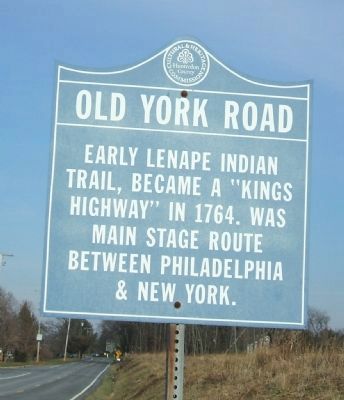
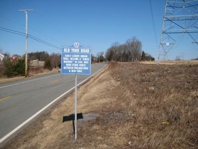
Old York Road
Erected by Hunterdon County Cultural and Heritage Commission.
Topics and series. This historical marker is listed in these topic lists: Native Americans • Roads & Vehicles. In addition, it is included in the New Jersey, Hunterdon County Cultural and Heritage Commission series list. A significant historical year for this entry is 1764.
Location. 40° 29.727′ N, 74° 48.561′ W. Marker is near Flemington, New Jersey, in Hunterdon County. Marker is on Old York Road (New Jersey Route 613 at milepost 1.2), on the right when traveling north. Touch for map. Marker is in this post office area: Flemington NJ 08822, United States of America. Touch for directions.
Other nearby markers. At least 8 other markers are within 2 miles of this marker, measured as the crow flies. Poor Farm (approx. 0.4 miles away); Mattisons Corner (approx. one mile away); Reaville Historic District (approx. 1.2 miles away); Reaville Church (approx. 1.3 miles away); Vietnam War Dogs Memorial (approx. 1.4 miles away); The Province Line (approx. 1˝ miles away); a different marker also named The Province Line (approx. 1˝ miles away); South Branch Historic District (approx. 1.6 miles away). Touch for a list and map of all markers in Flemington.
Additional commentary.
1.
The 2nd marker is in Ringos, NJ. Where routes 179 and 579 meet. The marker is visible northbound on route 179. Near mile marker 14.6 on Route 579.
— Submitted September 11, 2012, by John Ben Urban of Middletown, Delaware.
Credits. This page was last revised on June 16, 2016. It was originally submitted on March 5, 2009, by Alan Edelson of Union Twsp., New Jersey. This page has been viewed 2,004 times since then and 117 times this year. Last updated on January 8, 2013, by John Ben Urban of Middletown, Delaware. Photos: 1. submitted on January 17, 2013, by John Ben Urban of Middletown, Delaware. 2. submitted on March 5, 2009, by Alan Edelson of Union Twsp., New Jersey. • Bill Pfingsten was the editor who published this page.

