Near Sharpsburg in Washington County, Maryland — The American Northeast (Mid-Atlantic)
Jackson's Command
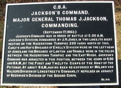
Jackson's Command
Major General Thomas J. Jackson,
Commanding.
(September 17, 1862.)
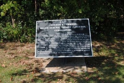
Jackson's Command was in order of battle at 5:30 a.m. Jackson's Division, commanded by J.R. Jones, in two lines, its right resting on the Hagerstown Turnpike 230 yards north of this. Early's and Hay's Brigades of Ewell's Division were on the left rear of Jones, and the Brigades of Lawton and Trimble were in the fields between the Hagerstown Turnpike and the East Woods. Jackson's Command was assaulted in this position, between the hours of 5:30 and 8 a.m., by the First and Twelfth Corps of the Army of the Potomac. At about 9 a.m., having been re-enforced by McLaws' and Walker's Division of Longstreet's Command, it repulsed an assault of Sedgwick's Division of the Second Corps.
Erected by Antietam Battlefield Board. (Marker Number 315.)
Topics and series. This historical marker is listed in this topic list: War, US Civil. In addition, it is included in the Antietam Campaign War Department Markers series list. A significant historical date for this entry is September 17, 1862.
Location. 39° 28.545′ N, 77° 44.81′ W. Marker is near Sharpsburg, Maryland, in Washington County. Marker is at the intersection of Confederate Avenue and Dunker Church Road / Old Hagerstown Pike, on the right when traveling west on Confederate Avenue. Touch for map. Marker is in this post office area: Sharpsburg MD 21782, United States of America. Touch for directions.
Other nearby markers. At least 10 other markers are within walking distance of this marker. "Destroy the Rebel Army" (within shouting distance of this marker); a different marker also named Destroy the Rebel Army (within shouting distance of this marker); Beacon of Peace (within shouting distance of this marker); Dunker Church - "Symbol of Peace and Brotherhood" (within shouting distance of this marker); 59th New York Infantry (within shouting distance of this marker); Longstreet's Command (within shouting distance of this marker); Twelfth Army Corps (within shouting distance of this marker); Second Army Corps (within shouting distance of this marker); a different marker also named Twelfth Army Corps (within shouting distance of this marker); Greene's Division, Twelfth Army Corps (within shouting distance of this marker). Touch for a list and map of all markers in Sharpsburg.
Also see . . .
1. Antietam Battlefield. National Park Service site. (Submitted on March 16, 2008, by Craig Swain of Leesburg, Virginia.)
2. Jackson's Command. Jackson, for all practical purposes, controlled the actions on the northern half of the battlefield, and directed the reinforcements that fed into the morning phase of the battle. However, with the confusion and intermingling with Longstreet's units, both generals were active directing troops in this area of the field. (Submitted on March 16, 2008, by Craig Swain of Leesburg, Virginia.)
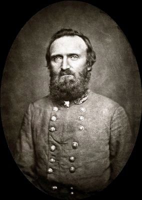
3. Stonewall Jackson. Thomas Jonathan "Stonewall" Jackson (January 21, 1824 – May 10, 1863) was a Confederate general during the American Civil War, and the best-known Confederate commander after General Robert E. Lee. (Submitted on October 15, 2015, by Brian Scott of Anderson, South Carolina.)
Photographed By Craig Swain, February 9, 2008
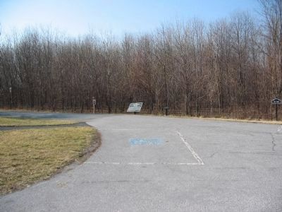
3. Confederate Tablets near the Dunker Church
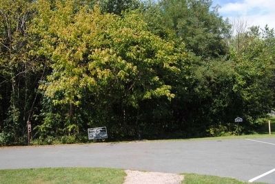
Two tablets for Jackson's Command, 315 (center, on the left) and 314 (missing, but the post is to the right of 315), stand to the north of the Dunker Church. On the far right a sign indicates the south edge of the West Woods.
Photographed By Craig Swain, February 9, 2008
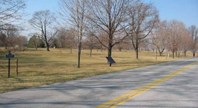
6. Jackson's Forward Positions
On the west side of the Old Hagerstown Pike, Jackson deployed his division, under J.R. Jones, oriented to the north. Two brigades were on line near the modern access road to the Philadelphia Brigade monument (obelisk in the far left) facing away from the camera to the north. The other two brigades of the division were a few hundred yards further south, also lined up facing north and perpendicular to the Pike.
Credits. This page was last revised on June 15, 2022. It was originally submitted on March 16, 2008, by Craig Swain of Leesburg, Virginia. This page has been viewed 973 times since then and 22 times this year. Photos: 1. submitted on March 16, 2008, by Craig Swain of Leesburg, Virginia. 2. submitted on October 15, 2015, by Brian Scott of Anderson, South Carolina. 3. submitted on March 16, 2008, by Craig Swain of Leesburg, Virginia. 4, 5. submitted on October 15, 2015, by Brian Scott of Anderson, South Carolina. 6. submitted on March 16, 2008, by Craig Swain of Leesburg, Virginia.
