Near Sharpsburg in Washington County, Maryland — The American Northeast (Mid-Atlantic)
"Destroy the Rebel Army"
GOD BLESS YOU AND ALL WITH YOU
DESTROY THE REBEL ARMY IF POSSIBLE
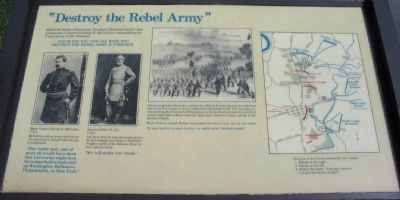
McClellan, with an army nearly twice the size of Lee's, thought that he was outnumbered:
"One battle lost, and almost all would have been lost. Lee's army might then have marched as it pleased on Washington, Baltimore, Philadelphia, or New York."
Lee knew that he was outnumbered, but he had brought this Army of Northern Virginia north of the Potomac River to win a great victory:
"We will make our stand."
The evening before the battle, combat artist Edwin Forbes sketched the soldiers of the Union First Corps as they waded across Antietam Creek. The crossing was well to the north of Sharpsburg, so the Southerners knew that the first attack would fall on Major General "Stonewall" Jackson's Corps waiting at the Dunker Church.
Major General Joseph Hooker commanded the First Corps, and he was ready:
"If they had let us start earlier, we might have finished tonight."
Topics. This historical marker is listed in this topic list: War, US Civil.
Location. This marker has been replaced by another marker nearby. 39° 28.531′ N, 77° 44.802′ W. Marker is near Sharpsburg, Maryland, in Washington County. Marker is at the intersection of Dunker Church Road / Old Hagerstown Pike and Smoketown Road, on the right when traveling south on Dunker Church Road / Old Hagerstown Pike. Located at stop one of the driving tour of Antietam Battlefield. Touch for map. Marker is in this post office area: Sharpsburg MD 21782, United States of America. Touch for directions.
Other nearby markers. At least 8 other markers are within walking distance of this location. A different marker also named Destroy the Rebel Army (here, next to this marker); Beacon of Peace (here, next to this marker); Dunker Church - "Symbol of Peace and Brotherhood" (here, next to this marker); Jackson's Command (within shouting distance of this marker); Twelfth Army Corps (within shouting distance of this marker); Second Army Corps (within shouting distance of this marker); a different marker also named Twelfth Army Corps (within shouting distance of this marker); 5th, 7th and 66th Ohio Infantry Monument (within shouting distance of this marker). Touch for a list and map of all markers in Sharpsburg.
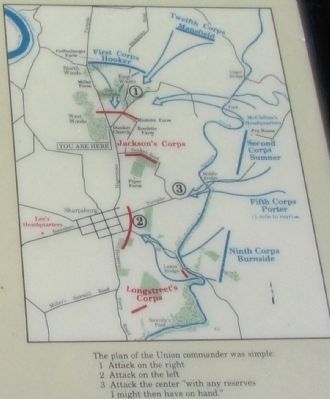
More about this marker. On the left side of the marker are portraits of Major General George B. McClellan, U.S.A. and General Robert E. Lee, C.S.A. The Edwin Forbes sketch is displayed in the upper center. A map on the right side details McClellan's plan of
battle.
Regarding "Destroy the Rebel Army". This marker was replaced by another titled "Destroy the Rebel Army" (see nearby markers).
Also see . . . Antietam Battlefield. National Park Service site. (Submitted on March 16, 2008, by Craig Swain of Leesburg, Virginia.)

Photographed By Craig Swain
3. Tour Stop One - the Dunker Church
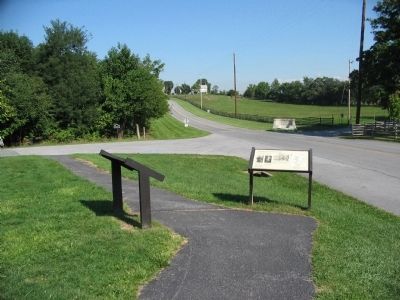
On the left is the Dunker Church interpretive marker. Facing the camera is the "Destroy the Rebel Army" interpretive marker. The 59th New York Infantry monument is opposite the church in the distance. Note the fold of the terrain in the background. This section of ground was contested throughout the morning of the battle.
Credits. This page was last revised on August 16, 2017. It was originally submitted on March 16, 2008, by Craig Swain of Leesburg, Virginia. This page has been viewed 1,430 times since then and 15 times this year. Photos: 1, 2, 3. submitted on March 16, 2008, by Craig Swain of Leesburg, Virginia.

