Twin Falls in Twin Falls County, Idaho — The American West (Mountains)
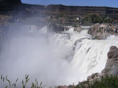
Shoshone Falls
The History of Shoshone Falls Dam
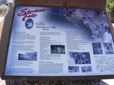
Shoshone Falls Hydroelectric Project.
In 1900 Ira B. Perrine began seeking investors for a hydroelectric plant at Shoshone Falls, ultimately forming the Shoshone Falls Power Company on March 9, 1904. In 1907, the site was sold to William S. Kuhn, and became the Great Shoshone and Twin Falls Water Power Company. The 500-kilowatt (kW) plant finally began generating power in August 1907.
The early days of Idaho’s electricity business were chaotic and ultimately forced the company into economic failure in 1914. Idaho Power Company was formed in 1916 from its assets and those of several other companies.
Idaho Power began a series of improvements at Shoshone Falls including expanding the powerhouse in 1921 to accommodate a 12,000-kilowatt generator. Expansion of the facility had its challenges. During the 1921 construction it is written:
“The work at Shoshone Falls presents transportation problems. A ferry (60) feet long and (20) feet wide has been built. It is driven by side paddle wheels, and has a capacity of (40) tons. Some very expensive road work makes it a possible to deliver machinery, some weighing 20 tons, down the steep and winding hillside to a point directly above the powerhouse from which it must be let down by a large cable controlled by a powerful electric hoist.”
A final dam structure was completed in 1927 to fully contain and redirect the river, making it possible to retain about 750 acre-feet of water to ensure a more constant volume for generation.
As a run-of-river dam it has a small 1,500 acre storage reservoir that extends about two miles upstream. Water in excess of the plant’s 950 cubic feet per second (cfs) hydraulic capacity flow over the falls. Idaho Power serves residential, business, and agricultural customers in southern Idaho and eastern Oregon, providing electricity in a 24,000 square-mile service area. Hydroelectric projects like this one provide about half of the company’s generation, while 40 to 45 percent comes from coal and natural gas-fired power plants. The remainder comes from wholesale market purchases.
General Plant Information
•Reservoir elevation: 3354.5 feet above sea level
•Acre feet in reservoir:1,500
•Tailwater elevation: 3,136 feet mean sea level (msl) at the point where it intersects the riverbed
•There are three generating units and four diversion dams, one gated and three fixed
•All three dams are ungated and function as uncontrolled overflow spillways
•About 1,000 cubic feet of water per second passes through the turbines
•Shoshone Falls Power Plant annually averages about 90,000 megawatt-hours (MWh) of electricity each year, enough to supply approximately 9,000 households. Historically, the average annual residential electricity use per household is approximately 12.7 MWh
•Idaho Power’s hydroelectric system has a total generating capacity of 1,706,715 kilowatts.
FERC Licensing
The Federal Energy Regulatory Commission (FERC) issued Idaho Power a 30-year operational license for the Shoshone Falls Project August 4, 2004. The license contains Protection, Mitigation and Enhancement (PM&E) measures that Idaho Power is committed to implementing over the term of the new license. The license requirements include protection for federally listed threatened and endangered snail species near the project, minimum stream flows to benefit aquatic species, spring habitat enhancements aesthetic flows, recreational facility enhancements, interpretive signage and protection measures for white sturgeon.
Facts, Specs & Stats
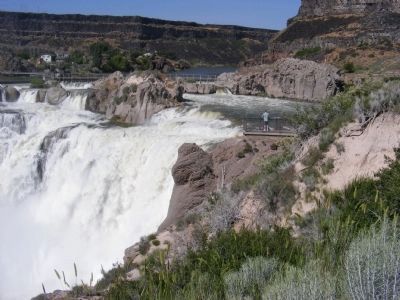
•The concrete diversion dam is about 800 feet long and averages about 16 feet high; its four sections are separated by rock islands at the crest of the falls
•The power plant has three generating units totaling 12.5 megawatts of installed capacity
•At peak efficiency the total maximum output under ideal conditions is 12,500 kilowatts
•Unit one was installed in the original 1907 project. Unit Two was added in 1909
•Unit Three was installed as part
of the 1921 addition
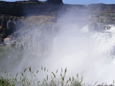
•The 137-foot powerhouse contains three turbine/generator units totaling 12.5 MW installed capacity
•A 450-foot-long concrete and steel tunnel provides water from the reservoir to the powerhouse
•A 100 foot-long tailrace channel carries water away from the powerhouse and returns it to the river
•The reservoir is 1.8 miles long
•The project occupies 1.98 acres of BLM lands
•One kilowatt equals 1,000 watts
•One megawatt equals 1 million watts
•One megawatt can power approximately 650 homes.
Topics. This historical marker is listed in these topic lists: Industry & Commerce • Waterways & Vessels. A significant historical month for this entry is March 2003.
Location. 42° 35.622′ N, 114° 24.102′ W. Marker is in Twin Falls, Idaho, in Twin Falls County. Marker is on Champlin Road (Route N3300E). The marker is located at the parking lot overlook at Shoshone Falls Park and may be reached via Shoshone Falls Grade. Touch for map. Marker is in this post office area: Twin Falls ID 83301, United States of America. Touch for directions.
Other nearby markers. At least 8 other markers are within 3 miles of this marker, measured as the crow flies. A different marker also named Shoshone Falls (a few steps from this marker); Clarence Bisbee (within shouting distance of this marker); a different marker also named Shoshone Falls (within shouting distance of this marker); Shoshone Falls Project (approx. ¼ mile away); History Through the Eyes of a Camera (approx. 2.3 miles away); Before there were potatoes, there was GOLD (approx. 2.3 miles away); Snake River Canyon Gold Rush (approx. 2.3 miles away); Robert Evel Knievel (approx. 2.7 miles away). Touch for a list and map of all markers in Twin Falls.
Credits. This page was last revised on June 16, 2016. It was originally submitted on February 3, 2013, by Don Morfe of Baltimore, Maryland. This page has been viewed 768 times since then and 37 times this year. Photos: 1, 2, 3, 4, 5, 6. submitted on February 3, 2013, by Don Morfe of Baltimore, Maryland. • Syd Whittle was the editor who published this page.
Editor’s want-list for this marker. Wide area view of the marker and its surroundings. • Can you help?
